skip to main |
skip to sidebar
... meant for hiking
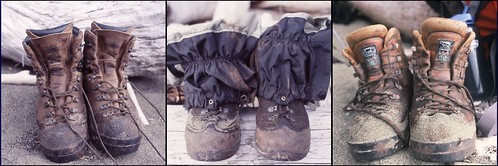 from left to right, boots belong to Derek, John and Greg.
August 21, 2004
There was no journal entry for the day. I was home. I was aching to see Meaghan; we had been apart for weeks. I was warm and dry and besides, it was late, we both just wanted to sleep.The day started wet. At least inside the tent it did. The fly was soaked inside and out and in many places dripped water onto the tent. In some spots drops fell through the tent's screen side, spraying everything beneath it in a light mist. There was one spot where water dripping from the fly pooled in the hollow of the polyester roof, where it in turn dripped down on me. Lying on my stomach to write the night before, drips landed squarely between my shoulder blades. When I woke in the morning my sleeping bag was damp all over and soaked through in three spots. Water will always find a way to follow gravity.It wasn't raining when we roused ourselves, but it was close. Slopping through a heavy mist we raced against the clouds to get packed up. Light drops of rain pelted me as I closed the top of my pack and slung it on my back. The tempo of the rain got faster as we progressed along the trail, but the canopy tricked us into thinking we would stay relatively dry for some time. Then we came to Pachena Lighthouse and stepped out from the protection of the trees. It was going to be a long, wet day. Derek(r) and Greg at Pachena Lighthouse where the gentle rain has turned to deluge. Out of the rainforest's canopy it became clear just how wet the day would be.The rest of the hike was largely spent in silence. It was too hard to hear each other. Babble on, the rain, echoed in the nylon lining of my hood; like my head was in a drum. Without my hood the water from the sky had nowhere to run save for down my back and chest. Cloistered in our shrouds we each at times led the way while the others followed, watching footsteps fall before us. It was tedious and monotonous, and periodically it was hazardous. The West Coast Trail is legendary for eating up hikers in the rain by so saturating their spirits with wet roots, slippery rocks and muddy sections of trail and we were feeling its wraith.Perhaps our spirits would have been lower had this been our first day, not our last. We passed people going the other way, heading south. Not many. How do you start a trip like this on these terms? What lay ahead for them? We slumped through rivulets of water that wore away at the gravel, rocks and roots that lay just beneath the surface of the hardpacked soil of the path. How will the rivulets wear away the comfort of the newcomers to the trail.We made good time. Bouyed by each passing distance marker, we counted down our way to Bamfield and the trailhead. The rain continued the whole way. We were off the trail by noon, and Meaghan picked us up. Wow, what a saviour she was. A rented van gave each of us space and she had a cooler full of food: sandwiches; muffins; orange and apple juice; and fruit by the bag, like grapes, peaches and apples.And dry, clean clothes, at least for me. I still stank underneath, but I had clean clothes to hold all the rankness in. I don't even want to describe the smell wafting up from the back seat of the van.
Derek and Greg ready to roll. Waiting, actually, at the Duke Point ferry terminal in Nanaimo. It was a two or three sailing wait and all the while we were waiting another ferry at the dock sat idling, generous streams of smoke coming from its stack.I woke that morning on a drizzly beach on the Pacific Ocean. By the time we got off the ferry, dropped Greg and Derek at Greg's place, and vacuumed and washed the van, it was after midnight. It would be days before the completeness of the trip would sink in. Five nights on the trail and not a single argument or raised voice. Glorious weather, a remarkable landscape and an openness to possibilities. Born, a tradition.
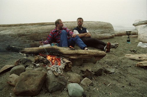 Derek and Greg relax at Michigan Creek.
 August 20, 2004
I am lying tonight in my tent listening to the sound of condensation dripping from the inside of my tent fly. A drop of water just trickled down my back. I may be wet in the morning.
Today was by far our laziest day on the trail. We reached the ‘anchor on rocks’ at trestle creek by 9 am and we had our tents pitched at Michigan Creek campsite by 1 pm. We owned the beach for most of the afternoon.
Greg stands alone at Michigan Creek.
I had a nap, as did Derek and, I think, Greg. For Greg, the usual first order of business when stopping for the day was to find a wide flat log suitable for basking on. He spent a fair amount of time with his eyes closed, lost in dreams both awake and not.
Greg talked a lot about his boys. He missed them. I felt bad about my phone not working. There were other hikers able to get reception, but my phone really is a piece of crap. Who knows, it may have been better for him in the end. What an opportunity to be away from everyone and everything for a week. Besides, I don’t think the batteries would have lasted.
Drip, drip, drip. It sounds a familiar refrain from another trip. [I'm not sure what trip I was referring to.]
We’ll be off the trail tomorrow. It will probably be odd to not have the sound of surf to go to sleep to. This whole trip has been a load of fun and I am sorry to see it coming to an end.
We played Yahtzee again this evening and again I rolled a Yahtzee and finished with a stellar score. I lost the 2nd game however. We followed this up with a few games of five-thousand. They caught on fast. Of the two games I think Yahtzee is more fun.
My body doesn’t ache tonight. It is hard to believe that by 1 pmish tomorrow we will have traveled 75 km on foot. Remarkable under the best of conditions, which we were fortunate to have.
I am ready for so many things in life now. I want to tell Meaghan all about them. Right now though, I just want to sleep. I look forward to drifting off to the rhythm of the waves on the beach and the soft pattering of the dew drips inside my tent.
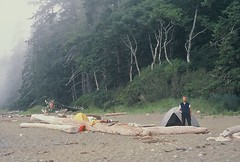
 Once my body and mind adjusted to the hike I spent a fair amount of time taking photos. The photo I was taking is here.photo credit:GregNorthVancouver.Ah, yes, the last night brought with it heavy fog, followed by really heavy mist, followed by drizzle. It was the kind of precipitation that didn't really fall. It lingered in the air, soaking everything it came in touch with. Lying in my tent that night I realized just how fortunate I was the weather on our trip had been good. My tent was as waterproof as a sieve. I hadn't used it in years, not since Meaghan and I got a larger tent as a wedding gift. Things would have been pretty tight if the three of us had had to share Derek's tent. I cannot imagine how rank the air would have been inside it. On the other hand I likely would have ditched the Tarn and saved some weight in my pack. Hmph. Prior to heading to Yoho last summer I tried to avoid the drip, dripping, by resealing the fly. No luck.In a previous post I mentioned trail etiquette and the etiquette-deficiency of some of those with whom I shared the trail. But beyond etiquette there are certain rules that back country hikers need to abide by. Etiquette, like burying human waste or packing out trash, eases the burden on the environment. Basic human etiquette allows trail weary campers to get along. A lack of etiquette likely won't kill you, although I can think of a few hikers that came close to dying in their sleep at the hands of other hikers. Rules on the other hand usually save lives; for instance, staying off some of the nastier beaches at high tide, or, say, storing food properly.We shared Michigan Creek campsite this night with, among others, a group of hikers who were full of bravado, energy and cockiness. It was their first night on the trail, having set out from Bamfield, and one or two of the more boisterous members of the group were 'teaching' the others how to do the back country thing properly. It was scary. I recall one of them pulled out a long-bladed hunting knife at any opportunity, and another guided the group through food prep - how hard can that be? Boil water, add to food, wait, eat.But the scariest thing was how they stored their food for the night. Like most of the campsites, Michigan Creek had a locker available for food and trash. It was set up away from the camping area, to steer any wayward bears away from campers. But it seems these guys wanted to show off their back-woodsiness by hanging their food from a tree. The night before, this is something we had no choice but to do. There were no food lockers at Klanawa Creek. But it was something we did responsibly. The food was many metres off the ground and away from our tents. Our Michigan Creek neighbors on the other hand hung their food just outside their campsite - three feet off the ground. Yes, it was secure from squirrels and raccoons, safe from sand fleas, but it was left at buffet level for any bear that happened to wander along the beach. Derek, Greg and I, while immersed in a game of Yahtzee, darkly hoped the guys who hung the food bag kept secret stashes of food tucked away in their tents. Better they be meals than us.
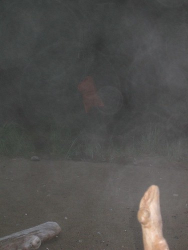
Stupidity kills. The red, blurry thing in the background is a bag of food left dangling tantalizingly close to the ground.photo credit:GregNorthVancouver.A daily ritual, usually performed both prior to hitting the trail and once we got off it, was water filtration. Using Derek's pump we would take turns gathering potable water. At around 80 pumps per litre and six to eight litres gathered at a time that was a lot of elbow action. On this occasion I was at the creek gathering water with Greg - he was pumping(now that I think about it, I'm pretty sure I did not do my fair share of pumping) - at the same time another man was filling up his own water bottles. His 12-year-old son was with him. They had hit the trail that morning in Bamfield and this was their first night of a bonding journey.
The son was full of energy, bounding around the creek from rock to rock, talking excitedly about the day they had finished, and the days left before them. I looked out at the Pacific Ocean, and the fog, and then at the sky and the heavy cloud and wondered if it wouldn't be wise for the kid to save some of his energy for the rest of the hike. I've thought about them many times since that encounter. Both were full of optimism, but I wonder if the torrential rain that came the following day somehow took an edge off their exuberance.  The loo at Michigan Creek.
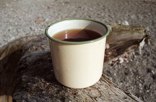 Every day of hiking ended with a cup of Earl Grey.
August 19, 2004
As we set up our tents for the evening, Greg lamented that we have only one night left on the trail after this. Easy to understand, I feel the same way. But, I’m also starting to stink and it has been a while since I saw Meaghan last. I miss her.
Night falls on the beach at Klanawa River.
The nights, evenings and, more recently, the afternoons have proven to be relaxing and beautiful.
Last night the whole sunset extravaganza, right down to silhouetted couples strolling through the sunfire at the oceans edge, seemed scripted for a film. It was marvelous. Tonight, the fire and the stars stand out. Our first night is a distant memory ( I remember the sense on the first night, back at campers cove, of being a member of the walking wounded) and I can only lay back and relish the freshness of the evening.
My shoulders hurt for awhile today and later in the day it felt like my Achilles was starting to stiffen up. I took some calcium and we’ll see in the morning how my body feels. Both slowed me throughout the day. The additional weight of the water taken on at Nitinat Narrows didn’t help much.
I can hardly wait to see Meaghan. I think that she’ll be proud of me for completing the trail in one piece. That’s something that matters to me. I am glad, though, that I am away from her for a little while: it let’s me think about her more.
We skipped Tsutsiat Falls for camping. In fact we didn’t even go down to the beach to see what it was all about, I think mainly because I didn’t want to deal with the ladders. Besides, here come the sour grapes, it didn’t look like much from the trail anyway.
Klanawa River beach. We used a cable car to cross the Klanawa River.
We continued for another kilometer to the Klanawa River site instead. Tonight there is only one other group camping on the beach with us. In the early evening a couple of kayakers pulled their boats up the beach and pitched their tents 40 meters to the south. The solitude leads me to think that we decided well to forgo the crowded scenery of Tsutsiat Falls.
 The crossing at Nitinat Narrows was full. This is one of my favourite photos from the trip. At Nitinat Narrows the character and class of some of my fellow hikers was fully exposed. On the one hand there was a group of four or six women doing the hike. This was our first up close and personal with them, and for the rest of the trip we kept crossing each other's paths. I can't remember any details about them except they were perpetually cheery and lighthearted in their approach to the hike. One woman had flown from Nova Scotia for the hike.
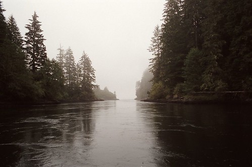 Nitinat Narrows.On the the other hand, there was a family of hikers that was a drag to be around- while boarding the boat I 'accidentally' stabbed the mother in the back with my walking pole. The red-headed daughter was impertinent and it seemed the mother was mentoring her in impertinence, as well as indignance and obnoxiousness. I remember on the last night watching in horror as the daughter, when asked to clean up after dinner, threw all the plastic meal bags on the fire. I wanted to brain her. Her father, whipped to the bone by his wife, puttered along the trail in a meek sort of daze, powerless to reign in the rest of the family.'We skipped Tsutsiat Falls ... ' I was feeling a little weary when we came to the side trail that leads down to the beach and the falls. I didn't look at any websites or photoblogs about the WCT prior to doing the hike and didn't have any idea of how striking the falls are. Part of me wishes I had taken the time to go down to check them out, take a picture or two. But there were ladders to descend (and for every ladder down there's usually a ladder up,) and by this point I had had my fill of climbing up and down ladders. I learned later that because of its beauty Tsutsiat Falls is the most popular camping area on the trail and is usually quite crowded. In fact while we looked longingly down the path to the beach two groups of campers made their way down for the night. Our decision to spend the night mostly alone at Klanawa River was indeed a wise one.
August 18, 2004
This has been a remarkable day. I’m not sure where to begin. The morning began with eagles in a tree … skip it, how do I describe so many things? Do I need to? I do.
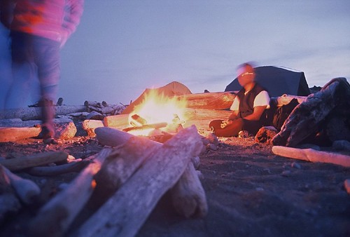
Of course, I didn't describe all the things I saw, though I did take photos. This was the first day I was feeling comfortable with a pack on my back. My spirits were up and there was a bit of a spring to my step. I think starting each day with a healthy dose of calcium and ibuprofin went a long way to keeping my body feeling good. The number of photos I took compared to the previous two days is a telling sign of how much better I was feeling. I shot most of two rolls of film. I am sitting under the stars near a fire. I have a makeshift desk to write on made from a toilet seat lid propped up on a log. It worked quite well for the Yahtzee we just played. It was my first game ever and I threw a Yahtzee. What a coup. My throat hurt from laughing so hard. I went on to win the game. What are the odds? (and of course I am writing all this on a toilet seat lid.)
Not only did I win the first game, and roll a Yahtzee along the way, I finished with an admirable 315. Miraculously, I went on to roll Yahtzee again in the second and third games. I mentioned in my first post this hike along the West Coast Trail was the beginning of a tradition. Part of that tradition is the playing of Yahtzee. I remember feeling a sense of glee sitting on the beach that crystal clear night, playing Yahtzee by the fire. It was some sort of crazy magic and in one moment I knew I wanted to do this more often. I never asked Greg or Derek, but to me that night stands out as part of the motivation behind making these hikes an annual event.Today we walked along the beach. A lot. At times we gingerly crossed flat sandstone ledges and at other times we walked on sand. There were different types and qualities of sand. Some was loose and similar in size to pea-gravel, less sand than pebbles, while other sand was fine and well compacted, making for easy hiking.
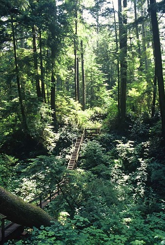
We hiked in the forest for a while as well. This is looking back at bridge 81.
Early in the day we came to the legendary restaurant on the beach. Not quite midway through the hike, it offers a reminder of things left behind; like meat dishes and cold alcoholic beverages. Set up on some of the first nations land the trail passes through, the restaurant isn't much more than vapour barrier wrapped around a light wooden frame. Inside, food is prepared in a kitchen with a sand floor. I only thought once about the cleanliness of the place before I had a burger and a beer. I don't imagine a health inspector is out very often, but I managed to survive the experience.
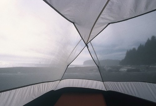
The view from my tent at the end of day three.
I can hear waves crash in the darkness. Pounding and foaming the surges sweep swiftly back down the beach and disappear.
Tonight we are very close to the half-way mark of the trail, camped on the beach. We are somewhere between km 38 and 37. What we will encounter tomorrow, who knows?
I miss you Meaghan. I want to share this with you. It’s something different.
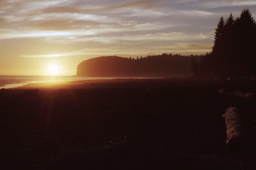
Sunset.
Goodnight.
August 12, 2004
Another long hump of a day is over, although not as much trail was covered as yesterday. Tomorrow could prove to be a long day of walking, but for the first time since we hit the trail we’ll be able to actually just walk for while.
The ladders have been numerous and, at times, nerve-wracking. At Cullite Creek we climbed down a deep gorge on a set of six or seven ladders. Each set was 25 to 30 rungs tall and they were each set at varied angles. At the bottom we had to take a cable car to the other side of the creek and then climb back up a similar set of ladders to the one we had just descended. I didn't like it.
We spent time today in silence and in conversation. Derek and I walked and talked for a while this morning. This afternoon I walked for a while with Greg.
Tonight we are staying on the beach at Walbran Creek. Our tents are pitched on tiny plots of sand, protected from the wind by giant logs washed up on the beach. A dozen other camps set up along the beach as well. Some we recognize from the trail or Camper Cove, others are unfamiliar. All the little fires; and poles stuck end up in the sand like totems. My hat sat for awhile on the handle of my walking pole, stuck like a flag-post near the entrance to my tent. Tribal nomads, we all stake a claim in a communal zone. Camping allows us to express the urges of our ancestors.
I miss Meaghan a lot. As I write this she is probably approaching YVR. Soon she will be home. I hope she is happy when she gets there and I hope she has an okay day at work in the morning.
I miss you babe.
I am having a hard time sleeping. I am excited about the prospects for tomorrow’s hike, and two tiny blisters have formed on two of my tiny toes. Both things sort of niggle at me.
Also keeping me awake is the relentless pounding of the surf. When we first arrived here I stopped and leaned against a log. I stood there, arms across my chest, and stared at the ocean doing its thing. Lying in the tent tonight I can hear the sound of the rocks being pulled down the beach by waves retreating into the ocean. It's no wonder all the stones are smooth. Sometimes the waves sound like a fall wind rustling dry leaves on branches. Or rain. Marvelous.
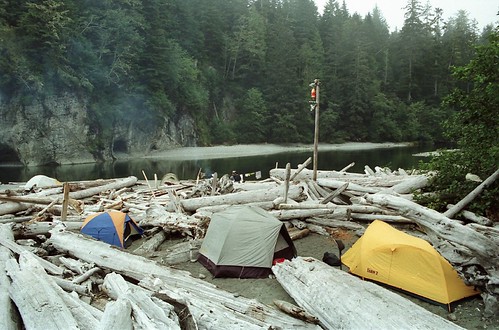
At Walbran Creek. Derek and Greg have the tent with the grey fly. My fly is yellow. Living quite happily among all the logs were garter snakes. Lots of them. This was rather unnerving to some of the campers.
I was just perusing some West Coast Trail info on the Parks Canada website. The site advises against first time back country hikers hitting the trail. Understandable. This was my first back country camping trip. To prove a point, on the morning of our second day I boiled something starchy, like oats or cream of wheat, for breakfast. That is the only time ever, while camping in the back country, that I have cooked a breakfast. It was too much hassle to clean up after. Clearly I had made a novice mistake. There are no sinks in the woods. Now sewers either. What else was left to learn?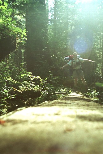 Derek at a log-bridge crossing. The morning sun eased all our pain.We packed and left Camper Bay. Starting at the base of a hill, the trail wove its way upward through switchbacks and along ridges. At twenty metres elevation, looking down through a gap in the trees at the beach we had just camped on, I worried about the trail ahead. My legs ached. My whole body ached. I took some calcium pills that would choke a grizzly, or two, and a couple ibuprofen tablets - I suppose they could choke a squirrel.
Thirty minutes later, and for the rest of the day, I felt fine. Apparently I was not going to die.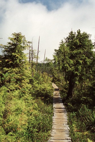 The first bit of walking was deceptive in its ease. This board walk, though a little crusty looking, was a nice break from dancing along a path warn down to roots and rocks.I may be exaggerating here on the number of ladders climbed at Cullite Creek, or how many rungs each ladder had, but the total number of rungs climbed was certainly into three figures. On each side of the creek. Climbing ladders was often an unnerving experience. Some were solid, sturdy and well anchored, obviously recently built. Others, not so sturdy or solid; some may only have been anchored to moss.
I remember flinging myself, relieved, over the last rung at the top of Cullite Creek. Derek and Greg were already at the top, I think, and the three of us rested wearily at the side of the trail. It was a humbling moment. From around the bend up the trail a woman and man in their twenties ran toward us. In their sneakers, lycra pants and hoodies they weren't what you expect to see on the trail. These two were definitely travelling light. Each wore small a hydration pack just large enough for food and a few necessities. They stopped briefly at the top of the ladders."Are you running the trail," one of us asked."yes," came the reply from between breaths."How long are you taking?" This question is usually squeezed into the first few minutes of conversation following an inter-tribal encounter. "Two days. We started yesterday morning."We sat in silence for a minute while the two runners discussed what lay ahead. There were more ladders, log bridges, bridges and boardwalks, as well as a bog or two to come. The man looked at his watch and as they started down the ladder we wished them good luck. A fleeting encounter with a couple whose entire encounter with the park has been fleeting. That's intense.
Despite any discomfort I may have felt in the morning, and how tired I was arriving at Walbran Creek, I think by the second night I had resigned myself to finishing the trail in one piece. Aches and the groans that went with them faded into the background, leaving an unimpeded view of the world I was walking through.
August 16, 2004
I’m too tired tonight to take pictures. Disappointment, the sunset is beautiful. We covered a lot of trail today, 13 kilometres to Camper Bay. Now everything below my hips feels heavy; the soles of my feet are compressed. Some of the hikers with whom we crossed Gordon River stopped for their first night at Thrasher Cove, five kilometres in to the trail.
The kilometre 62 signpost sits somewhere not-too-far ahead of us along the trail. When we get to it our day of hiking (tomorrow) on the trail will have just begun. I owe my progress to this point to Meaghan. It is her strength that helped me through some difficult moments of today’s hike. All the words she has been saying to me are finally sinking in.
Sadly, I feel better in the company of misery: Greg’s shoulders hurt, Derek simply sags and my hip is sore in two places. The morning will be telling.
Camper Bay is partly protected from the open water by a thin spit of sandstone. The spit might be more protective if it didn’t disappear with the tide. The surface of it is pocked and cracked, a maze of pits and crevices offering a bare knuckle existence.
Right now I can feel the tightness in my neck. I hope I don’t hurt tomorrow.
done.
Thanks Meaghan. I can’t talk anymore. I miss you. Goodnight. xo
'Ferry to West Coast Trail' was hand scrawled, along with an arrow pointing to the dock, on a large piece of white painted ply-wood. The sign was tacked to the wall of a building standing on the bank of Gordon River. It was all the assistance we would get heading to the trail. Parks Canada has a pre-hike briefing that is mandatory for hikers entering the West Coast Trail. I'm not sure what the briefings brief you for, but, no doubt rules are explained, a heads-up is given for things that will kill you if not treated with respect; for example, pointy toothed animals, surging tides, or breathing second-hand smoke. Possibly, there would be a lecture on what lengths a person has to go to to get assistance leaving the trail. Blisters don't cut it.
There was no briefing. Instead there was a locked building and little instruction. Though I can not remember, there were likely two notes stuck to the door of the building: one to tell hikers Parks Canada and its employees were in the middle of a strike, the other to tell hikers the union and the park were having a labour dispute. That was too bad. Derek, Greg and I saw other hikers on the trail do funny things, things they should not have been doing. There were plenty of people on the trail who could have learned a thing or two at the briefing, including, I'm sure, the three of us as well. 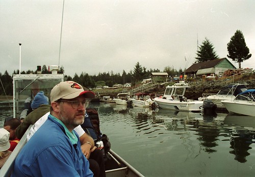 Derek ponders whatever Derek ponders as he crosses Gordon River. Seventy-five kilometres to go.By the map we walked just shy of 13 kilometres. Not by the map, we probably walked closer to 14 km. What a horrible way to start the hike. Somehow we got onto a side trail that looped back almost to the beginning of the trail. Once on track we eventually encountered our first ladders and bridges, and came to ravines spanned by great logs with flattened edges. Soon we had climbed high above sea level where, standing at the edge, all the bigness of the coast was revealed.
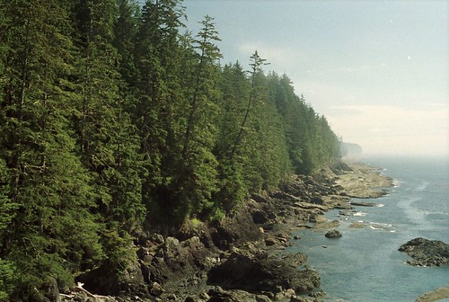 Soon we were high above the level of the ocean, standing at the edge, and all the bigness of the coast was revealed.We arrived at Camper Bay late in the afternoon, closing on evening. There were a lot of people there and the best spots were spoken for. We staked our tents lower down the beach, beyond the informal log boundary inside which most of the tents were pitched. We planted ours on a slant in loose pebbles. I didn't care. I just wanted the tent up, and to cook some food and veg by a fire. While contemplating that last bit, the fire, the one I really wanted to have, I looked about at the rest of the campground: Derek, Greg and I represented but one of a dozen tribes, each one or two tents in size, at the campground. Each tribe had a fire. A dozen fires smoldered and a dozen lazy wisps of grey smoke rose into the air. A scarce resource was burning at an alarming rate. We were camped at the periphery of a cultural model that was economically doomed to failure.I ate and went to sleep.
In August of 2004 a tradition was born: three men walked into the woods for a week of exploration. Now mind you the details of that tradition have changed somewhat from year to year. In '05 it was four of us that walked into the woods, and last year, though back to three, the woods weren't open yet, so we hung around a campsite and did day hikes. This year, again a bit of a change, the woods will be open but my body isn't ready for the weight of a pack and I'm lacking somewhat in stamina.But this isn't about the year to come, or last year, it's about the first year. A daring year. A somewhat ambitious year, considering the hike chosen. And as you will read in the journal entry to follow, I was a hiker filled to the brim with trepidation. I knew one of my hiking partners as an acquaintance, and the other not at all. Greg was one of Meaghan's co-workers, and it was he who had always wanted to hike the West Coast Trail. He brought to the mix myself and Derek, a friend of his whose relationship dates back to high school. (from left) Greg, Uncle Alfie and Derek wait at the Tsawassen ferry terminal for a lift to Vancouver Island. Alfie was kind enough to drive us from Vancouver to Port Renfrew where we would step onto the West Coast Trail at its southern trail head. Alfie hiked the West Coast Trail 25 years earlier on a whim, taking the place of a hiker who bailed on his group at the last minute. He was in his fifties then, hadn't conditioned his body for the hike, and survived just fine. Alfie's story was somewhat reassuring. But not totally.
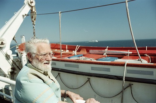 The day started beautifully in Vancouver and our trip across Georgia Strait on the Queen of Saanich was all sun all the way. I think Alfie was diggin' it.Weather is perhaps the single most important factor in determining the successful outcome of traversing the 75 kilometres of trail. A wet trip will make for falls, dunks, discomfort, and I suspect a degree of rage. Oh, and don't forget that despondent feeling that can hang over you like a cloud over Schleprock. Regardless of what the weather forecast said we could expect over the coming week, the Pacific is notorious for being completely uncooperative with weather prognostications. Upon our arrival in Port Renfrew and setting up of our tents clouds moved in, bringing with them fog. Not a good sign.
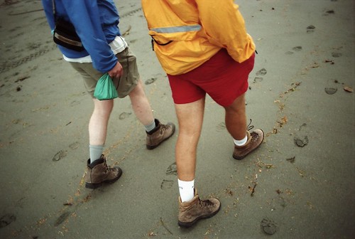 Derek and Greg walking along the beach. I'm looking at their foot placement now, especially Greg's(r), and I'm amazed they aren't tripping over themselves. Good grief, how did we survive the hike.
August 15, 2004
First day okay. Mind you we didn’t actually hit the trail yet. Fuck, I hope everything is okay. Meaghan says it will be, so it must be.
I miss Meaghan. That she is in Fredericton has been distance enough. But, now we’re incommunicado. What if I need her?
Really, I am actually nervous about tomorrow. The objective over the course of six days, is to cover 75km of trail while carrying 40 pounds of gear. Ouch. I am carrying everything that I need to survive 7 days in the woods, possibly longer.
40 pound pack? Maybe. That's one of the questions I've been asked many times: "how heavy is your pack when you go camping?" I don't have a clue. For the WCT I didn't want to know. Sometimes it's better that way. These days I'm curious, but I still feel I'm better off hiking in ignorance. Psychologically I can make the pack as light as the logical part of my mind will allow. Sometimes I wish I was a little less logical. I mean really, how heavy can it be?This is not normal and likely I should have been preparing for this, physically. I’m not sure that my body will take the first day, let alone a week.
We’ll see. Tomorrow it begins. I'll stretch in the morning.
I distinctly remember leaning against the trail head sign in the morning and doing about five minutes of stretching while silently repeating to myself, 'you're not going to die, you're not going to die.'
I missed a few days of journalling. A lot of days actually. In fact I pretty much skipped the journal for the last week of my trip. The reasons are explained in my final entry, though I can chalk it up mostly to laziness. Possibly beer and scotch too.However, to say I stopped recording the highlights and observations of my journey once I left Bruce Peninsula National Park wouldn't be an accurate statement. Of course I was still taking photos which, if anything, offer a condensed though concise narration of my journey. Therefore I offer to my many readers, all three of you near as I can tell, a photo essay of the last leg of my journey. At the end, where it duly belongs, is my last journal entry.This journey east served many purposes. The pragmatice reasoning behind the whole venture was a transition from one place to another: the departure from Vancouver and ultimate arrival in Fredericton. But along the way, along the thin line I travelled from point A to B, the journey was about discovering and connecting with the people and places in between. For a month I was in an odd sort of purgatory, in between one life and another, that was at once pleasant and uncomfortable.It was pleasant because I knew there were faces along the way waiting to see me. I knew there were spaces I wanted to explore, that were open to exploration, and that were offering surprises to my open mind. It was pleasant because I never once wondered what the hell I was doing. But it was uncomfortable, not because I spent hours a day confined to a car, but because as the hours stretched into days, and the days into weeks, I came to understand there was no way in hell I could ever see it all. Even if I made it my life's pursuit to do so. Canada is like infinity: it's easy to talk about, and think you know about, but when you really put the effort into conceptualizing it something snaps inside your brain. Canada is beyond description, beyond understanding, beyond explanation.Day 20: June 21, 2006
 On my journey I spent time with both family and friends. But I also found time for fake family. Sharon's mom lives in the farm the Perdue family has worked for a century in Chatsworth, Ontario. I stopped in to have coffee and cake with her on the afternoon I left Bruce Peninsula.
 I stayed with Charlotte, her son Connor and her mother Faye(not shown) in Barrie, Ontario. Charlotte and I were best friends in high school and she's one of the only people from that era I'm still connected with. It was nice to finally meet Connor. It's not often you get to spend the night in a five-year-old's room for the night.
Day 21: June 22, 2006
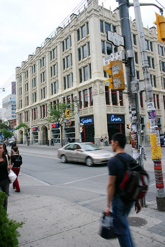 I spent two action packed days in Toronto. Sharon and I went for a couple of beers before dinner. The few hours I spent with her was one of the highlights of my journey east. It had been a year and a bit, or more, since she moved from Vancouver and it was nice to chill with her. Oddly enough, I didn't take a photo of her. But we did go for a walk after dinner and stumbled across MuchMusic's HQ along the way. Notice the street it's on.
Day 22: June 23,2006
 Johnny G's is where Graeme and I had breakfast while in Toronto. I stayed with him at his place
 in
Cabbagetown. I think if I lived in Toronto I would like to live in that area of town. The community has character in its buildings, its businesses, and most of all in its people.Day 23: June 24, 2006
Graeme joined me for the last leg of my trip to Fredericton. I can't see for certain the last time we might have travelled together, but it could have been on our family trip to Newfoundland in 1976. Thirty years ago and I hadn't really thought about it at the time. On the way out of Toronto we stopped in to see Beth, our cousin, and her husband Stephen and their two daughters Anna and Leah. They were in the final stages of packing their house up for a move to Kingston. Apparently our timing was impeccable and Graeme and I were put to work on some heavy lifting. Thanks for the coffee guys.From there it was on to the 401 headed for Montreal. Along the way we stopped in for a bowl of fresh picked strawberries at Mary and Ross's home in Cobourg. Mary is mom's sister and I hadn't seen any of the McDonalds in close to 15 years. The strawberries were nice and it was good to connect with them again. Gordon Krieger moved in two houses down from me on Francklyn Street when I was three and he was two. At the time, and for years afterward, Gordon was known as Twoey. The previous November I had dinner with him in Vancouver. That was the first I had seen him in a really long time. Probably the same amount of time since I had last seen the McDonalds. We stayed with him while in Montreal(these are the stairs to his place) and again it was a nice reunion. I have to say this about Montrealers: they know how to give 'er when driving. The Montreal Grand Prix was held that weekend and when we hit the highways running into the city, four narrow lanes of twisted concrete and potholes, everyone seemed to be driving for the checkered flag. I'm of the understanding that Grand Prix or not, Montrealers adopt a certain joie de vivre when they get behind the wheel. It was not for the faint of heart.
 Day 24: June 25,2006
We didn't linger long in Montreal. In the morning we were on the road again. Originally I had planned a stay along Le Chemin du Roy, or Kings Highway, running from Montreal to Quebec City. But by this time on the journey I was getting a little road weary so we took the old road only halfway, to Trois-Rivieres, before crossing the St. Lawrence River and hopping back on the Trans Canada Highway. Our pace was quickened and we bypassed Quebec City and headed for the New Brunswick border.  My last night spent on the road we stayed at De la Republique campground just outside Edmundston. The beer was moderately cold. The mosquitoes were manageable. The firewood was burnable (which isn't always the case.) And life was feeling pretty good.
Day 25: June 26, 2006
 From Edmunston it was a liesurely trip through New Brunswick's country-side. This is the only photo taken along the way which wasn't shot by me. Thanks Graeme. By mid-afternoon we were in Fredericton. The long journey east was over.
June 27, 2006
So, here I am, my first full day in Fredericton. I'm a little at a loss for what to do with myself and have a few weeks and months ahead to adjust to my new surroundings. I'm happy to be here and it was a sweet reunion with Meaghan. One month and three days passed between two kisses: one at her departure, and one upon my arrival.
My writing suffered toward the end of the trip. Time in Barrie with Charlotte was limited, so visiting took precedent over journalling. Time in Toronto, though two-days long, was compressed as well. Then an evening in Montreal and another in Edmundston, New Brunswick. I think by that last night my brain was a little frazzled in anticipation of the following day's arrival in Fredericton.
Life here with Meaghan's father will take some adjusting to. No longer will Meaghan and I have the freedom and privacy of our own place. James is a great guy, but he has his own peculiarities that will take some getting used to.
I have yet to get out to explore the city. That will come once Graeme is off to Halifax, tomorrow.
june 20, 2006
Me, writing in my journal at the end of the day.
Another day comes to a close, but before getting into today's events a note about last night. Usually the last thing I do before sleeping is read. Last night, as is generally the case, I was only able to get through a couple of pages before my eyes began to lose focus. When I turned off my lamp all was black.
The night was darkest of dark in my tent. The kind where I couldn't even see my hand held in front of my face. I couldn't even make out its silhouette. The only hint of life beyond the faric of my tent walls were the sounds of the woods.. Even at that it was fairly limited sound, mainly of the human kind coming from campsites in the vicinity. Like that of Ryan and Jillian.
Ryan and Jillian are at the park to celebrate Jillian's birthday. Both live in Barrie, where I'll be tomorrow night, both work in bars and both are in their early 20's. They did the same thing last year for Jillian's birthday. Ryan said one of the first things they found in common with each other when they met was their love for this area of Ontario and it brings them to the Bruce often.
(A raccoon just jumped up on the picnic table - I have spent the last ten minutes or so totally engrossed in the campfire. What a wonder. Campfires like this, the hissing of still damp wood, the light crackling sound, flames licking into the air, the smell of smoke on the air, on my clothes, touch me deep down inside. From the depths rises a nostalgic longing for times past, for my childhood, and for times not so long left behind. While hiking the West Coast Trail the best part of the day was the end of the day gathered around a fire on the beach, playing yahtzee, drinking tea and scotch, and watching the sky grow dark and eventually fill with stars. Nothing beats it.)
This morning I immediately struck out on a hike around Cyprus Lake. Following my experiences in the Rockies it seemed too easy to hike along such level terrain. The trail wasn't very well maintained and exposed roots and rocks made for careful walking. I saw more of the ground than of scenery, but the scenery I did see made the hike worthwhile. At the western end of the Lake I crossed a short bridge spanning the sleepy creek which feeds the lake. Bull rushes grew in abundance and white lilies were just starting to bud on lily pads. The sound of bullfrogs periodically thudded through the air.
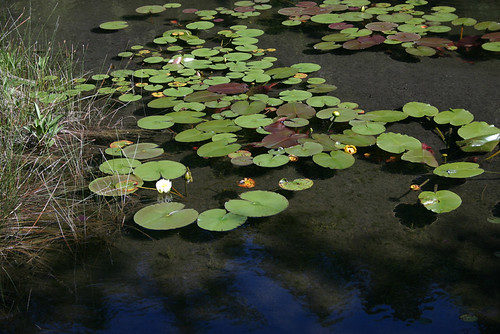
Lilies grow along the creek that feeds Cyprus Lake.
Although today's temperature didn't get up much higher than 20c it was hot in the sun. Walking among the firs and hardwoods of the trail left me refreshed for most of the hike and made for pleasant walking. It also brought a soft quality to the woods I walked through; sun and shade intermingled in a pleasant balance.
It took an hour to round the western point of the lake and return along the opposite shoreline to where the trail hooked back up with the campground. Here the path diverged: back to camp or onward to Marr Lake. I headed to Marr Lake which, according to the map, is nestled just a stone's throw from Georgian Bay.
This area, the Bruce Peninsula, is the northern point of the Niagara Escarpment. Soft limestone dolomite was laid down 400-million years ago during the paleozoic era. At the time the area was covered by an ocean, now the stone sticks up through the soil throughout the region and creates the jagged profile of the eastern shoreline along Georgian Bay. Along the trails, the soft stone is worn smooth by countless footsteps and the wear of time.
As I drew closer to Marr Lake I thought I could hear waves crashing on a beach. It was a sound that reminded me of Cape Breton. It was the sound of waves crashing not on a beach of sand, but on a beach of rounded stones or pebbles. It was a sound I hadn't been expecting. I emerged from the shaded protection of the forest and found myself at Marr Lake. Again, I had visions of Cape Breton.
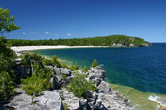
A five-metre high stone bar, like a sand bar, was all that separated Marr Lake from Georgian Bay. I got my first teasing glimpse of Georgian Bay, a streak of deep ocean blue to the horizon. What a thrill it was as a cool wind blew in and I was instantly transported to Wreck Cove, Nova Scotia.
I stood at a sign post pointing travellers in a variety of directions: Bruce Trail, north or south; Georgian Trail, south; Marr Lake Trail, west (from whence I came.) I was joined by a tourist from Holland whose English was limited. He seemed to appreciate my use of the word amazing so I repeated it many times. Really, it was the only word that did justice to the place we both, each from a different land, stood on. A bar of ash coloured stones, ranging in size from a walnut to a man, stretched from headland to headland and at the shore waves came rolling in under a cloudless blue sky. What a joy. Amazing.
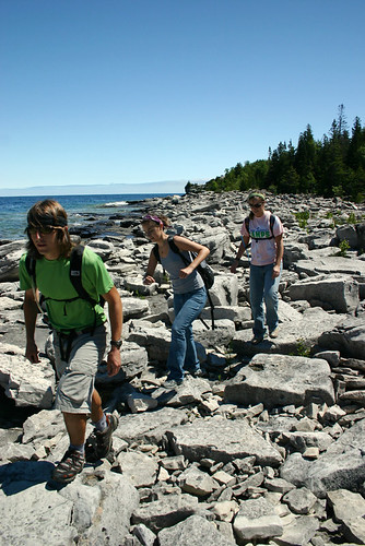
Three of the dozen or so hikers I passed during my hike.
I went south toward the Grotto. Beyond the beach the stones grew large, eventually giving way to bedrock. Great steps of striated stone, tiers, leading eventually to a cave worn out of the side of the escarpment I was climbing. Five metres high and a little less wide, the grotto sits at the edge the Grotto sits just above the level of the lake, but dips down beneath the water once inside. I didn't go down. For foolish and not-so-foolish reasons I didn't go down to it. I wasn't sure I was allowed into the Grotto in the first place, and considering I had to climb down to it I didn't think it was wise to make the trip alone. But more foolishly, I wasn't sure what direction the tide was going. I would hate to have been trapped down there. It wasn't until later I remembered there are no tides on the great lakes.
Looking back at the cove near Marr Lake. Georgian Bay water is a wonder.
The immensity of the Great Lakes kept messing with my head. They look like oceans, therefore they must have tides. But they don't. Additionally, the notion of dipping a cup into the ocean to quench one's thirst is absurd. But the lakes are lakes, fresh water. Drink all you want. I didn't test this latter observation. Back at the campsite I made a connection with events on east coast.Every year, hundreds of thousands of people are drawn to Peggy's Cove just outside Halifax. They go to see the lighthouse and the quaint fishing village it's built around. Once there many go for walks along the bare, smooth, granite rocks at the edge of the Atlantic Ocean. It's a spectacular place for storm watching. But every once in a while someone gets too close to all the action and ends up in the churning foam of monster waves. It's usually a rogue wave, one larger than the rest, that tricks the hapless tourist and flushes him out to see. And it seems, quite often, the poor sap is from Ontario. Is the foolishness born out of the same misunderstanding I had with the waters of Lake Superior and the Georgian Bay? Do they not understand the reach and power of an ocean?I continued on past the Grotto to Indian Head Cove. Indian Head Cove would be a great place to take a girl on a date. Sheltered and barely 100 metres wide, the cove is framed by cliffs 20 metres high on two sides with a small pebble beach set slightly off the middle. A ledge set next to the beach was occupied by a family having a picnic. Waves periodically smashed against its leading edge and launched great plumes of water into the sky.
It was at Indian Head Cove that I realized the stone of the area was a gentle off-white, not grey as the ledgestone in the photo would indicate.
It was on the beach at Indian Head Cove where I finally clued in to the true colour of the rocks of the Bruce Peninsula. The beach was a pebble beach and the stones on its shore were worn smooth by the action of countless years of pounding surf and waves. A rolling stone gathers no moss, nor does it gain the patina of age. All through out the area were stones coloured not grey, but a subtle off-white. The beach was almost too bright to look at.
From hidden cove it was a short walk through the woods and back to the campground. It was nice to get back into the shade of the trees.
Kayakers at sunset on Cyprus Lake.
I am tired and soon will head to bed. I just walked down to the beach at Cyprus Lake and spent some time lying on my back watching the stars above. There wasn't a hint of breeze and the silence, though interrupted by the throaty cough of frogs in the distance and the odd haunting call of a wayward loon, was sorely needed.
June 19, 2006225 kilometres travelled today. 5,044 km travelled total. High temperature was 21c.I've been parked for two-and-a-half hours at the ferry dock in South Baymouth waiting for the afternoon sailing. I managed to get a good nap in, badly needed, and to set up the tent to dry it out from last night's rain. The geology/geography of Manitoulin Island is interesting. I'll have to come back some time and learn about it. Manitoulin Island geology. Layers of limestone are visible everywhere you go on the island.The sailing from Manitoulin Island to the Bruce Peninsula was uneventful. Fog obscured most of the view from the deck of the Chi-Cheemaun and a strong wind blowing in from the southwest kept me inside for most of the crossing. It was cold on deck. As the ferry pulled into the dock at Tobermory a dark thunder cloud was moving in with the wind. What a surprise.I was frustrated with the situation and further frustrated because I let it frustrate me. I'm not sure why I let it frustrate me. There was a time in my life when I was more resilient to obstacles and I rolled with the punches. Now I fight them and in my head I let worst-case scenarios get the better of me. At that moment, coming off the ferry, I was picturing another thunderstorm in the future.So I land at Tobermory. Frustrated. Like a child, I'm piqued that I'm not the first one off the ferry, even though I was the first car on. I tear through Tobermory, barely glancing at the town, and head, single-mindedly, for Bruce Peninsula National Park. In front of me a group of motorcycles pull over not minutes from the ferry. Some of the riders didn't put rain-gear on when they had the chance. In my mind I flip them the bird for not having the sense to put their slicks on while they were at the ferry. Ten kilometres down the highway I miss the turnoff for the campground - I am a notorious u-turner, just ask Meaghan. Back on track I turn up the road to Cyprus Lake campground and the first sign I come across says 'campground full.'WTF? It's a Monday, and the season is still 10 days away from getting into high gear. Whatever. Five kilometres farther down the gravel road I arrive at the registration office. It is closed and the instructions for what to do under the circumstances aren't really clear. I head into the campground area anyway to see exactly how 'full' the park is. Tamarack is one of three campgrounds and there is not a soul to be found anywhere. Not a tent, trailer or car to be seen. So much for the campground being full. Unless it is occupied by ghosts and phantoms. At this point, as the knuckles on my hand grasping the steering wheel lost some of their whiteness, I realized I had been racing to this point in a heightened state of urgency when there was no urgency.I went back to the registration office for a more thorough examination of the various postings. I could hear thunder in the distance. It figures. Considering the plethora of campsites available I decide to wait out the rain and head back into Tobermory for a closer look and if possible, find some beer.
 The liquor store was closed. No pop to be had either.Tobermory is closed. Quite literally, every shop, diner, ice cream stand, and general store has a 'sorry, we're closed' sign hung in its window or door. I did find a liquor store but, of course, it too was closed. The only place I found open was a Greek pub. At least it was advertised as a pub. There were no cars in the parking lot. I walked into the plain interior of the 'pub,' though it didn't resemble any pub I had ever been in, expecting to be turned away: "sorry, we're closed. I just haven't gotten around to putting the sign in the door and shuttering the windows." Instead, I found a woman sitting alone at a table in the dining room, among two-dozen empty tables. She instantly rose to greet me with a smile. I waved to her casually and told her she didn't have to get up. "Is there any place in town I can get a six-pack," I asked.Her smile faded slightly. "No," she replied. At this point, considering the emptiness of the place, I expected her to implore me to sit for a meal, but there was nothing more said. The place was truly empty. In my travels to this point I passed through a number of ghost towns, but this was the first one to actually be populated yet still have no sign of life. I found it mystifying that a town that relied so much on the tourist trade would shut down completely at six o'clock.I did, however, find a post office where I mailed postcards written on the ferry, and I found the library to which I'll return tomorrow to learn more about the town.Once again I headed out of town toward the park. This time though I paid closer attention to the community through which I was passing, and I realized I had to re-evaluate my notion of what Toermory is all about. Alng the way I passed at least half-a-dozen shops and inns that will not open this tourist season. Tobermory, at its town centre, seemed vibrant if not a little sleepy. One or two kilometres down the road though and a different story was being told. One place I passed looked like it was once a restaurant. It had closed signs in a couple of its papered over windows and the white washed clapboard siding was in need of more white wash. Grass grew wild around the building and garbage was piled against the wall.As I approached the campground, for the second time, the rain seemed to have passed and the sky was brightening. I toured Birches campground this time and found what looked to be a nice site. There were barely a dozen other campers set up in the area, and considering the surplus of empty sites, I didn't see a need to encroach on anyone's privacy.
 The campground is 'full' of phantoms and ghosts. I caught one scampering through my site, chasing squirrels.It is a nice site. Minutes from the lake, like most of the sites, it is hemmed in tight by fir and birch trees. Interestingly, all the sites have two picnic tables. This, together with the warnings at the front gate that boisterous revellers will be evicted, I presume this is a bit of a party campground for weekend partyers up from Owen Sound or maybe even Barrie. Regular shrieking in the distance seems to partly confirm this.The sun is fully gone. The only evidence of its passing a faint glow on the horizon. Stars now fill the sky in place of clouds and all the frustration I felt earlier is gone, replaced by a sense of wonder and awe and a desire for tomorrow to come. I am ready to explore.
 Sunset over Cyprus Lake.
Day 17 begins.
A funny thing happened on the way to the forum.Not everything noted in my journey east journal is making it to these pages. I made brief notes along the way on roadside observations, transcripts from audio notes, and points I thought I would follow up on, but didn't. I could write them here verbatim, but they wouldn't always make sense. Take this for example:Milestone math problems. Distance marked to Thunder Bay varied. Finish clock from 722km at Manitoba border sign and 705km at Kenora. arrived at 712km.
Milestones indicating the distance to a notable destination didn't always add up. In this case, when I crossed the Manitoba/Ontario border, the sign said it was 722km to Thunder Bay. I did some quick math with my odometer to see what the mileage would be when I got there. But as I travelled closer to Thunder Bay, and did more math as I passed more signs telling me the distance to the city, my end mileage calculated varied by 17 km. It struck me that in this day and age of gps navigation and satellite mapping that the highway department couldn't get the math right.So what? Well, that's sort of my point. Some of the notes I made are too vague to post and hope the reader will get anything out of them, and once explained, at length, aren't really that interesting.On the other hand, there are also notes that though they are as cryptic in meaning as the first example, may very well bear expanding on. Like this one:Great insect massacre. Evidence smeared across the front of the car.
Picture a swarm of large, crusty, flying things impacting the front of the car at 100 km/h. Now imagine the same scenario piloting a motorcycle. I passed through such a swarm just as I was passing a clutch of motorcycles and I felt so sorry for the poor bastards riding next to me. Better still, listen to what I had to say on the subject: bugs and buzzards.Having said all this, there is a point I was going to make, above and beyond just pointing to the little bits I've left out of my postings and why they've been left behind. A funny thing happened on the way to Fredericton. Actually, lots of funny things happened and there were interesting things, and arresting things, and poignant things. They were the kind of things that made me stop and ponder my place in the world. If I wrote about all those things I'd be writing all day, and you, the reader, wouldn't have time for it all. So I'll leave them for another day, another forum, and when I can, when I feel it just can't wait, I'll pop one into these writings. Oh, and I have more recordings where the bugs and buzzards came from. Heading back along the Sleeping Giant the fog set in for good. Not far from here I had my first bear sighting since B.C.
June 18, 2006
847 kilometres travelled today. The high temperature was 24c and the low was 11c.
It was a rather uneventful day of travel today. I made some audio notes along the way, but I'm not sure I want to go to the car to get my voice recorder. Lazy. The mosquitoes are pretty nasty too.
I'm tired tonight. It was another long day of driving and I'm spent. Fuck it, I'll go get the recorder. But first, today's playlist: Bruce Springsteen, The River disk one; Phil Collins, Face Value; James Blunt, Back to Bedlam; Jack Johnson, In Between Dreams; Crash Test Dummies, Give Yourself a Hand; Gordon Lightfoot, Greatest Hits; Murray McLaughlin, Gulliver's Taxi; Collective Soul, Disciplined Breakdown.
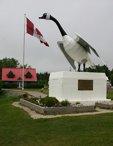
The giant Canada Goose at Wawa, Ontario. How can you not stop to take a photo?
I'm not sure when it happened, though I think it was when I left Lethbridge, I stopped listening to a cd more than once. I Had at least 70 or 80 cds with me and figured it would be a great opportunity to listen to them all. So I grabbed one of the three cases I had, started at the front, and worked my way back. No selection. No choice. Whatever was next in line got played. That's where the daily playlist fits in. It made for some interesting driving too. And serendipitous. While travelling the coast of Lake Superior near where the Edmund Fitzgerald sank in 1975 Gordon Lightfoot's ode to the wreck cycled through on the playlist. The fog was thick and the coincidence left me with chills.
notes that might make sense:
-Ridiculously thick fog. Crawling along at 80 km/h looking for coffee on a Sunday morning in the middle of no where: "I hope there's someplace that has coffee. There better be ..." I haven't experienced sustained fog like this since I left the maritimes. Another reminder of where I'm heading.
-At a store with a moose painted on its side, in the parking lot, a replica of a natural stone spire which stands 25km back the way I've come. I didn't stop to see the real thing. Now I'm reduced to admiring, and I use that term loosely, a replica over reality. I'm so 21st century.
-I passed three Amish-looking men riding two horse-drawn carriages along the Trans Canada Highway. Odd.