Showing posts with label moving east. Show all posts

Wednesday, June 13, 2007

journey east: day 26 - Fredericton

I missed a few days of journalling. A lot of days actually. In fact I pretty much skipped the journal for the last week of my trip. The reasons are explained in my final entry, though I can chalk it up mostly to laziness. Possibly beer and scotch too.

However, to say I stopped recording the highlights and observations of my journey once I left Bruce Peninsula National Park wouldn't be an accurate statement. Of course I was still taking photos which, if anything, offer a condensed though concise narration of my journey. Therefore I offer to my many readers, all three of you near as I can tell, a photo essay of the last leg of my journey. At the end, where it duly belongs, is my last journal entry.

This journey east served many purposes. The pragmatice reasoning behind the whole venture was a transition from one place to another: the departure from Vancouver and ultimate arrival in Fredericton. But along the way, along the thin line I travelled from point A to B, the journey was about discovering and connecting with the people and places in between. For a month I was in an odd sort of purgatory, in between one life and another, that was at once pleasant and uncomfortable.

It was pleasant because I knew there were faces along the way waiting to see me. I knew there were spaces I wanted to explore, that were open to exploration, and that were offering surprises to my open mind. It was pleasant because I never once wondered what the hell I was doing. But it was uncomfortable, not because I spent hours a day confined to a car, but because as the hours stretched into days, and the days into weeks, I came to understand there was no way in hell I could ever see it all. Even if I made it my life's pursuit to do so. Canada is like infinity: it's easy to talk about, and think you know about, but when you really put the effort into conceptualizing it something snaps inside your brain. Canada is beyond description, beyond understanding, beyond explanation.

Day 20: June 21, 2006
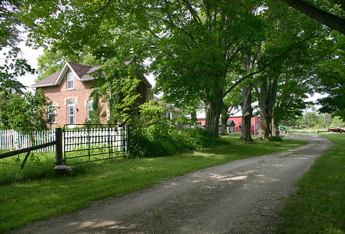
Perdue farm
On my journey I spent time with both family and friends. But I also found time for fake family. Sharon's mom lives in the farm the Perdue family has worked for a century in Chatsworth, Ontario. I stopped in to have coffee and cake with her on the afternoon I left Bruce Peninsula.
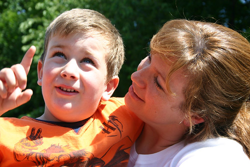
Connor and Charlotte
I stayed with Charlotte, her son Connor and her mother Faye(not shown) in Barrie, Ontario. Charlotte and I were best friends in high school and she's one of the only people from that era I'm still connected with. It was nice to finally meet Connor. It's not often you get to spend the night in a five-year-old's room for the night.

Day 21: June 22, 2006
Muchmusic
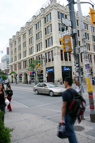
I spent two action packed days in Toronto. Sharon and I went for a couple of beers before dinner. The few hours I spent with her was one of the highlights of my journey east. It had been a year and a bit, or more, since she moved from Vancouver and it was nice to chill with her. Oddly enough, I didn't take a photo of her. But we did go for a walk after dinner and stumbled across MuchMusic's HQ along the way. Notice the street it's on.

Day 22: June 23,2006
breakfast at Johnny Gs
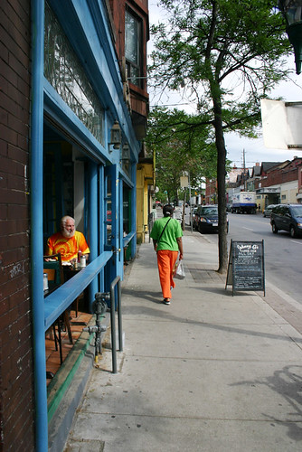
Johnny G's is where Graeme and I had breakfast while in Toronto. I stayed with him at his place in Cabbagetown. I think if I lived in Toronto I would like to live in that area of town. The community has character in its buildings, its businesses, and most of all in its people.

Day 23: June 24, 2006

Graeme joined me for the last leg of my trip to Fredericton. I can't see for certain the last time we might have travelled together, but it could have been on our family trip to Newfoundland in 1976. Thirty years ago and I hadn't really thought about it at the time.

On the way out of Toronto we stopped in to see Beth, our cousin, and her husband Stephen and their two daughters Anna and Leah. They were in the final stages of packing their house up for a move to Kingston. Apparently our timing was impeccable and Graeme and I were put to work on some heavy lifting. Thanks for the coffee guys.

From there it was on to the 401 headed for Montreal. Along the way we stopped in for a bowl of fresh picked strawberries at Mary and Ross's home in Cobourg. Mary is mom's sister and I hadn't seen any of the McDonalds in close to 15 years. The strawberries were nice and it was good to connect with them again.
Montreal
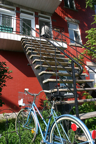
Gordon Krieger moved in two houses down from me on Francklyn Street when I was three and he was two. At the time, and for years afterward, Gordon was known as Twoey. The previous November I had dinner with him in Vancouver. That was the first I had seen him in a really long time. Probably the same amount of time since I had last seen the McDonalds. We stayed with him while in Montreal(these are the stairs to his place) and again it was a nice reunion.

I have to say this about Montrealers: they know how to give 'er when driving. The Montreal Grand Prix was held that weekend and when we hit the highways running into the city, four narrow lanes of twisted concrete and potholes, everyone seemed to be driving for the checkered flag. I'm of the understanding that Grand Prix or not, Montrealers adopt a certain joie de vivre when they get behind the wheel. It was not for the faint of heart.

Day 24: June 25,2006

We didn't linger long in Montreal. In the morning we were on the road again. Originally I had planned a stay along Le Chemin du Roy, or Kings Highway, running from Montreal to Quebec City. But by this time on the journey I was getting a little road weary so we took the old road only halfway, to Trois-Rivieres, before crossing the St. Lawrence River and hopping back on the Trans Canada Highway. Our pace was quickened and we bypassed Quebec City and headed for the New Brunswick border.
De la République Provincial Park
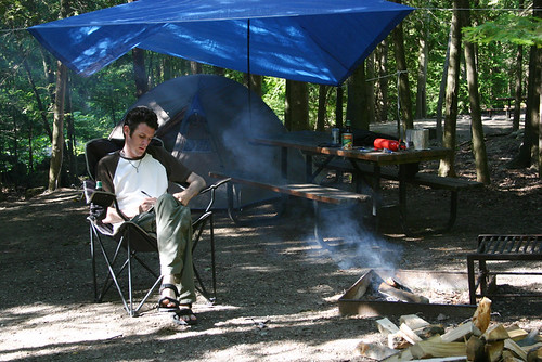
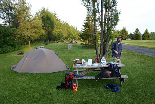
My last night spent on the road we stayed at De la Republique campground just outside Edmundston. The beer was moderately cold. The mosquitoes were manageable. The firewood was burnable (which isn't always the case.) And life was feeling pretty good.

Day 25: June 26, 2006
john coming over the hill
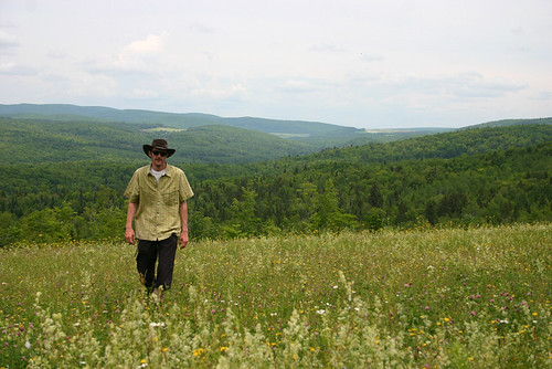
From Edmunston it was a liesurely trip through New Brunswick's country-side. This is the only photo taken along the way which wasn't shot by me. Thanks Graeme. By mid-afternoon we were in Fredericton. The long journey east was over.

June 27, 2006

So, here I am, my first full day in Fredericton. I'm a little at a loss for what to do with myself and have a few weeks and months ahead to adjust to my new surroundings. I'm happy to be here and it was a sweet reunion with Meaghan. One month and three days passed between two kisses: one at her departure, and one upon my arrival.

My writing suffered toward the end of the trip. Time in Barrie with Charlotte was limited, so visiting took precedent over journalling. Time in Toronto, though two-days long, was compressed as well. Then an evening in Montreal and another in Edmundston, New Brunswick. I think by that last night my brain was a little frazzled in anticipation of the following day's arrival in Fredericton.

Life here with Meaghan's father will take some adjusting to. No longer will Meaghan and I have the freedom and privacy of our own place. James is a great guy, but he has his own peculiarities that will take some getting used to.

I have yet to get out to explore the city. That will come once Graeme is off to Halifax, tomorrow.

Tuesday, June 05, 2007

journey east: day 19

june 20, 2006

self portrait
Me, writing in my journal at the end of the day.

Another day comes to a close, but before getting into today's events a note about last night. Usually the last thing I do before sleeping is read. Last night, as is generally the case, I was only able to get through a couple of pages before my eyes began to lose focus. When I turned off my lamp all was black.

The night was darkest of dark in my tent. The kind where I couldn't even see my hand held in front of my face. I couldn't even make out its silhouette. The only hint of life beyond the faric of my tent walls were the sounds of the woods.. Even at that it was fairly limited sound, mainly of the human kind coming from campsites in the vicinity. Like that of Ryan and Jillian.

Ryan and Jillian are at the park to celebrate Jillian's birthday. Both live in Barrie, where I'll be tomorrow night, both work in bars and both are in their early 20's. They did the same thing last year for Jillian's birthday. Ryan said one of the first things they found in common with each other when they met was their love for this area of Ontario and it brings them to the Bruce often.

(A raccoon just jumped up on the picnic table - I have spent the last ten minutes or so totally engrossed in the campfire. What a wonder. Campfires like this, the hissing of still damp wood, the light crackling sound, flames licking into the air, the smell of smoke on the air, on my clothes, touch me deep down inside. From the depths rises a nostalgic longing for times past, for my childhood, and for times not so long left behind. While hiking the West Coast Trail the best part of the day was the end of the day gathered around a fire on the beach, playing yahtzee, drinking tea and scotch, and watching the sky grow dark and eventually fill with stars. Nothing beats it.)

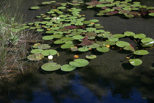
This morning I immediately struck out on a hike around Cyprus Lake. Following my experiences in the Rockies it seemed too easy to hike along such level terrain. The trail wasn't very well maintained and exposed roots and rocks made for careful walking. I saw more of the ground than of scenery, but the scenery I did see made the hike worthwhile. At the western end of the Lake I crossed a short bridge spanning the sleepy creek which feeds the lake. Bull rushes grew in abundance and white lilies were just starting to bud on lily pads. The sound of bullfrogs periodically thudded through the air.

Water Lilies
Lilies grow along the creek that feeds Cyprus Lake.

Although today's temperature didn't get up much higher than 20c it was hot in the sun. Walking among the firs and hardwoods of the trail left me refreshed for most of the hike and made for pleasant walking. It also brought a soft quality to the woods I walked through; sun and shade intermingled in a pleasant balance.

It took an hour to round the western point of the lake and return along the opposite shoreline to where the trail hooked back up with the campground. Here the path diverged: back to camp or onward to Marr Lake. I headed to Marr Lake which, according to the map, is nestled just a stone's throw from Georgian Bay.

This area, the Bruce Peninsula, is the northern point of the Niagara Escarpment. Soft limestone dolomite was laid down 400-million years ago during the paleozoic era. At the time the area was covered by an ocean, now the stone sticks up through the soil throughout the region and creates the jagged profile of the eastern shoreline along Georgian Bay. Along the trails, the soft stone is worn smooth by countless footsteps and the wear of time.

As I drew closer to Marr Lake I thought I could hear waves crashing on a beach. It was a sound that reminded me of Cape Breton. It was the sound of waves crashing not on a beach of sand, but on a beach of rounded stones or pebbles. It was a sound I hadn't been expecting. I emerged from the shaded protection of the forest and found myself at Marr Lake. Again, I had visions of Cape Breton.

A five-metre high stone bar, like a sand bar, was all that separated Marr Lake from Georgian Bay. I got my first teasing glimpse of Georgian Bay, a streak of deep ocean blue to the horizon. What a thrill it was as a cool wind blew in and I was instantly transported to Wreck Cove, Nova Scotia.

I stood at a sign post pointing travellers in a variety of directions: Bruce Trail, north or south; Georgian Trail, south; Marr Lake Trail, west (from whence I came.) I was joined by a tourist from Holland whose English was limited. He seemed to appreciate my use of the word amazing so I repeated it many times. Really, it was the only word that did justice to the place we both, each from a different land, stood on. A bar of ash coloured stones, ranging in size from a walnut to a man, stretched from headland to headland and at the shore waves came rolling in under a cloudless blue sky. What a joy. Amazing.

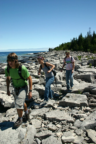
Georgian Bay trio
Three of the dozen or so hikers I passed during my hike.

I went south toward the Grotto. Beyond the beach the stones grew large, eventually giving way to bedrock. Great steps of striated stone, tiers, leading eventually to a cave worn out of the side of the escarpment I was climbing. Five metres high and a little less wide, the grotto sits at the edge the Grotto sits just above the level of the lake, but dips down beneath the water once inside. I didn't go down. For foolish and not-so-foolish reasons I didn't go down to it. I wasn't sure I was allowed into the Grotto in the first place, and considering I had to climb down to it I didn't think it was wise to make the trip alone. But more foolishly, I wasn't sure what direction the tide was going. I would hate to have been trapped down there. It wasn't until later I remembered there are no tides on the great lakes.

Georgian Bay
Looking back at the cove near Marr Lake. Georgian Bay water is a wonder.


The immensity of the Great Lakes kept messing with my head. They look like oceans, therefore they must have tides. But they don't. Additionally, the notion of dipping a cup into the ocean to quench one's thirst is absurd. But the lakes are lakes, fresh water. Drink all you want. I didn't test this latter observation. Back at the campsite I made a connection with events on east coast.

Every year, hundreds of thousands of people are drawn to Peggy's Cove just outside Halifax. They go to see the lighthouse and the quaint fishing village it's built around. Once there many go for walks along the bare, smooth, granite rocks at the edge of the Atlantic Ocean. It's a spectacular place for storm watching. But every once in a while someone gets too close to all the action and ends up in the churning foam of monster waves. It's usually a rogue wave, one larger than the rest, that tricks the hapless tourist and flushes him out to see. And it seems, quite often, the poor sap is from Ontario. Is the foolishness born out of the same misunderstanding I had with the waters of Lake Superior and the Georgian Bay? Do they not understand the reach and power of an ocean?

I continued on past the Grotto to Indian Head Cove. Indian Head Cove would be a great place to take a girl on a date. Sheltered and barely 100 metres wide, the cove is framed by cliffs 20 metres high on two sides with a small pebble beach set slightly off the middle. A ledge set next to the beach was occupied by a family having a picnic. Waves periodically smashed against its leading edge and launched great plumes of water into the sky.

Indian Head Cove detail
It was at Indian Head Cove that I realized the stone of the area was a gentle off-white, not grey as the ledgestone in the photo would indicate.

It was on the beach at Indian Head Cove where I finally clued in to the true colour of the rocks of the Bruce Peninsula. The beach was a pebble beach and the stones on its shore were worn smooth by the action of countless years of pounding surf and waves. A rolling stone gathers no moss, nor does it gain the patina of age. All through out the area were stones coloured not grey, but a subtle off-white. The beach was almost too bright to look at.

From hidden cove it was a short walk through the woods and back to the campground. It was nice to get back into the shade of the trees.

kayak at sunset on Cyprus Lake
Kayakers at sunset on Cyprus Lake.

I am tired and soon will head to bed. I just walked down to the beach at Cyprus Lake and spent some time lying on my back watching the stars above. There wasn't a hint of breeze and the silence, though interrupted by the throaty cough of frogs in the distance and the odd haunting call of a wayward loon, was sorely needed.

Monday, June 04, 2007

journey east: day 18

June 19, 2006

225 kilometres travelled today. 5,044 km travelled total. High temperature was 21c.

I've been parked for two-and-a-half hours at the ferry dock in South Baymouth waiting for the afternoon sailing. I managed to get a good nap in, badly needed, and to set up the tent to dry it out from last night's rain. The geology/geography of Manitoulin Island is interesting. I'll have to come back some time and learn about it.

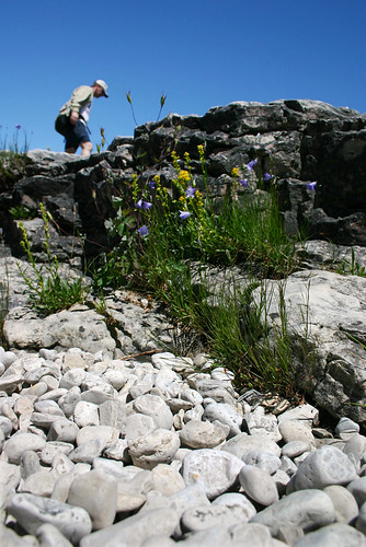
flower and bedrock
Manitoulin Island geology. Layers of limestone are visible everywhere you go on the island.

The sailing from Manitoulin Island to the Bruce Peninsula was uneventful. Fog obscured most of the view from the deck of the Chi-Cheemaun and a strong wind blowing in from the southwest kept me inside for most of the crossing. It was cold on deck. As the ferry pulled into the dock at Tobermory a dark thunder cloud was moving in with the wind. What a surprise.

I was frustrated with the situation and further frustrated because I let it frustrate me. I'm not sure why I let it frustrate me. There was a time in my life when I was more resilient to obstacles and I rolled with the punches. Now I fight them and in my head I let worst-case scenarios get the better of me. At that moment, coming off the ferry, I was picturing another thunderstorm in the future.

So I land at Tobermory. Frustrated. Like a child, I'm piqued that I'm not the first one off the ferry, even though I was the first car on. I tear through Tobermory, barely glancing at the town, and head, single-mindedly, for Bruce Peninsula National Park. In front of me a group of motorcycles pull over not minutes from the ferry. Some of the riders didn't put rain-gear on when they had the chance. In my mind I flip them the bird for not having the sense to put their slicks on while they were at the ferry. Ten kilometres down the highway I miss the turnoff for the campground - I am a notorious u-turner, just ask Meaghan. Back on track I turn up the road to Cyprus Lake campground and the first sign I come across says 'campground full.'

WTF? It's a Monday, and the season is still 10 days away from getting into high gear. Whatever. Five kilometres farther down the gravel road I arrive at the registration office. It is closed and the instructions for what to do under the circumstances aren't really clear. I head into the campground area anyway to see exactly how 'full' the park is. Tamarack is one of three campgrounds and there is not a soul to be found anywhere. Not a tent, trailer or car to be seen. So much for the campground being full. Unless it is occupied by ghosts and phantoms.

At this point, as the knuckles on my hand grasping the steering wheel lost some of their whiteness, I realized I had been racing to this point in a heightened state of urgency when there was no urgency.

I went back to the registration office for a more thorough examination of the various postings. I could hear thunder in the distance. It figures. Considering the plethora of campsites available I decide to wait out the rain and head back into Tobermory for a closer look and if possible, find some beer.

Tobermory sign
The liquor store was closed. No pop to be had either.

Tobermory is closed. Quite literally, every shop, diner, ice cream stand, and general store has a 'sorry, we're closed' sign hung in its window or door. I did find a liquor store but, of course, it too was closed. The only place I found open was a Greek pub. At least it was advertised as a pub. There were no cars in the parking lot.

I walked into the plain interior of the 'pub,' though it didn't resemble any pub I had ever been in, expecting to be turned away: "sorry, we're closed. I just haven't gotten around to putting the sign in the door and shuttering the windows." Instead, I found a woman sitting alone at a table in the dining room, among two-dozen empty tables. She instantly rose to greet me with a smile. I waved to her casually and told her she didn't have to get up.

"Is there any place in town I can get a six-pack," I asked.

Her smile faded slightly. "No," she replied. At this point, considering the emptiness of the place, I expected her to implore me to sit for a meal, but there was nothing more said. The place was truly empty. In my travels to this point I passed through a number of ghost towns, but this was the first one to actually be populated yet still have no sign of life. I found it mystifying that a town that relied so much on the tourist trade would shut down completely at six o'clock.

I did, however, find a post office where I mailed postcards written on the ferry, and I found the library to which I'll return tomorrow to learn more about the town.

Once again I headed out of town toward the park. This time though I paid closer attention to the community through which I was passing, and I realized I had to re-evaluate my notion of what Toermory is all about. Alng the way I passed at least half-a-dozen shops and inns that will not open this tourist season. Tobermory, at its town centre, seemed vibrant if not a little sleepy. One or two kilometres down the road though and a different story was being told. One place I passed looked like it was once a restaurant. It had closed signs in a couple of its papered over windows and the white washed clapboard siding was in need of more white wash. Grass grew wild around the building and garbage was piled against the wall.

As I approached the campground, for the second time, the rain seemed to have passed and the sky was brightening. I toured Birches campground this time and found what looked to be a nice site. There were barely a dozen other campers set up in the area, and considering the surplus of empty sites, I didn't see a need to encroach on anyone's privacy.

oooh scary
The campground is 'full' of phantoms and ghosts. I caught one scampering through my site, chasing squirrels.

It is a nice site. Minutes from the lake, like most of the sites, it is hemmed in tight by fir and birch trees. Interestingly, all the sites have two picnic tables. This, together with the warnings at the front gate that boisterous revellers will be evicted, I presume this is a bit of a party campground for weekend partyers up from Owen Sound or maybe even Barrie. Regular shrieking in the distance seems to partly confirm this.

The sun is fully gone. The only evidence of its passing a faint glow on the horizon. Stars now fill the sky in place of clouds and all the frustration I felt earlier is gone, replaced by a sense of wonder and awe and a desire for tomorrow to come. I am ready to explore.

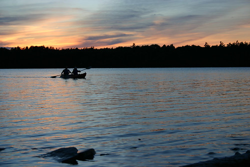
sunset at Cyprus Lake
Sunset over Cyprus Lake.

Friday, June 01, 2007

journey east: day 17

great morning
Day 17 begins.

A funny thing happened on the way to the forum.


Not everything noted in my journey east journal is making it to these pages. I made brief notes along the way on roadside observations, transcripts from audio notes, and points I thought I would follow up on, but didn't. I could write them here verbatim, but they wouldn't always make sense. Take this for example:
Milestone math problems. Distance marked to Thunder Bay varied. Finish clock from 722km at Manitoba border sign and 705km at Kenora. arrived at 712km.
Milestones indicating the distance to a notable destination didn't always add up. In this case, when I crossed the Manitoba/Ontario border, the sign said it was 722km to Thunder Bay. I did some quick math with my odometer to see what the mileage would be when I got there. But as I travelled closer to Thunder Bay, and did more math as I passed more signs telling me the distance to the city, my end mileage calculated varied by 17 km. It struck me that in this day and age of gps navigation and satellite mapping that the highway department couldn't get the math right.

So what? Well, that's sort of my point. Some of the notes I made are too vague to post and hope the reader will get anything out of them, and once explained, at length, aren't really that interesting.

On the other hand, there are also notes that though they are as cryptic in meaning as the first example, may very well bear expanding on. Like this one:
Great insect massacre. Evidence smeared across the front of the car.
Picture a swarm of large, crusty, flying things impacting the front of the car at 100 km/h. Now imagine the same scenario piloting a motorcycle. I passed through such a swarm just as I was passing a clutch of motorcycles and I felt so sorry for the poor bastards riding next to me. Better still, listen to what I had to say on the subject: bugs and buzzards.

Having said all this, there is a point I was going to make, above and beyond just pointing to the little bits I've left out of my postings and why they've been left behind. A funny thing happened on the way to Fredericton. Actually, lots of funny things happened and there were interesting things, and arresting things, and poignant things. They were the kind of things that made me stop and ponder my place in the world. If I wrote about all those things I'd be writing all day, and you, the reader, wouldn't have time for it all. So I'll leave them for another day, another forum, and when I can, when I feel it just can't wait, I'll pop one into these writings. Oh, and I have more recordings where the bugs and buzzards came from.

rail trestle
Heading back along the Sleeping Giant the fog set in for good. Not far from here I had my first bear sighting since B.C.
June 18, 2006

847 kilometres travelled today. The high temperature was 24c and the low was 11c.
It was a rather uneventful day of travel today. I made some audio notes along the way, but I'm not sure I want to go to the car to get my voice recorder. Lazy. The mosquitoes are pretty nasty too.

I'm tired tonight. It was another long day of driving and I'm spent. Fuck it, I'll go get the recorder. But first, today's playlist: Bruce Springsteen, The River disk one; Phil Collins, Face Value; James Blunt, Back to Bedlam; Jack Johnson, In Between Dreams; Crash Test Dummies, Give Yourself a Hand; Gordon Lightfoot, Greatest Hits; Murray McLaughlin, Gulliver's Taxi; Collective Soul, Disciplined Breakdown.
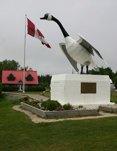
Wawa you sort of have to take a picture
The giant Canada Goose at Wawa, Ontario. How can you not stop to take a photo?

I'm not sure when it happened, though I think it was when I left Lethbridge, I stopped listening to a cd more than once. I Had at least 70 or 80 cds with me and figured it would be a great opportunity to listen to them all. So I grabbed one of the three cases I had, started at the front, and worked my way back. No selection. No choice. Whatever was next in line got played. That's where the daily playlist fits in. It made for some interesting driving too. And serendipitous. While travelling the coast of Lake Superior near where the Edmund Fitzgerald sank in 1975 Gordon Lightfoot's ode to the wreck cycled through on the playlist. The fog was thick and the coincidence left me with chills.

notes that might make sense:

-Ridiculously thick fog. Crawling along at 80 km/h looking for coffee on a Sunday morning in the middle of no where: "I hope there's someplace that has coffee. There better be ..." I haven't experienced sustained fog like this since I left the maritimes. Another reminder of where I'm heading.
-At a store with a moose painted on its side, in the parking lot, a replica of a natural stone spire which stands 25km back the way I've come. I didn't stop to see the real thing. Now I'm reduced to admiring, and I use that term loosely, a replica over reality. I'm so 21st century.
-I passed three Amish-looking men riding two horse-drawn carriages along the Trans Canada Highway. Odd.


Wednesday, May 30, 2007

journey east: day 16

June 17, 2006

It was a long stretch of driving today(819 kilometres,) but manageable. A good night's sleep will set me straight for another long haul tomorrow.
I don't have much to make note of today. I am now into the eastern time zone, which will carry me to the New Brunswick/Quebec border. With Manitoba several hundred km behind me I have once and truly left the west. Geographically the change was gradual. Over a 100 km stretch east of Winnipeg the landscape gradually began to roll and the highway gained curves, and what were periodic copses of trees eventually began to grow together into small forests and then again grew into large forests. I have been driving among trees for the better part of the day.

An audio note from the road transcribed at the end of the day: quality of road inversely proportional to distance travelled from Winnipeg, though still better than Saskatchewan. I've just passed through 30-40 km of mixed forest with no sign of communities. It is nice to be back travelling through wooded land - driving down a corridor of green with a blue ceiling. The open spaces of the prairie can be almost oppressive.

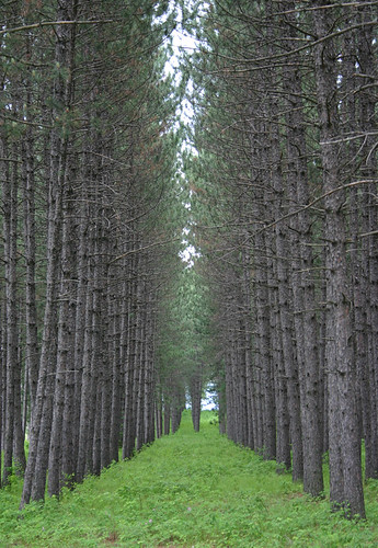
jackpine seed orchard
A jackpine seed orchard near Kakabeka Falls, Ontario.

The weather was fine all the way through to my final destination of Sleeping Giant Provincial Park just east of Thunder Bay. Fittingly, for the location, the lightning and thunder accompanied by heavy rain began mere moments after I pegged in the tent-fly. Just my luck, in a weird sort of way. The last time I fiddled with a tent in a thunderstorm was in Grasslands National Park, but then I was taking the tent down, in a panicked sort of fashion, and reached the dry, and lightning-proof confines of my car at the exact moment the first globs of rain hit the windshield. I must be a thunderstorm magnet. Tonight's was the third storm in as many nights of camping, spanning three provinces, two time zones, and 1800 km. I wonder what tomorrow night will bring.

Sleeping Giant park is beautiful. As the last daylight fades, and the rain drifts northward, I can hear the haunting call of loons coming from somewhere across the lake I'm camped at the shore of. Now that the rain has passed other birds are finding their voices and their songs are filling the air. Together with the loon-calls and the sound of rain-soaked leaves dripping all around me it is like I'm immersed in one of those nature sound-tracks you find in patchouli scented stores and Hallmark card shops.

no looking back
no turning back.

Today's playlist: Blues Traveller, Four; Jack Johnson, On and On; Dave Matthews with Tim Reynolds - live, disk one; Wallflowers, Bringing Down the Horse; various artists' covers of Leonard Cohen, Tower of Song; Madonna, Confessions on a Dance Floor; Pink Floyd, Echoes; Johnny Cash, The Best of Johnny Cash.

I just stepped out of the tent. I was drawn out by lights in the sky I could see through the tent's screen. The forest is filled with fire flies. It's been a long time since I last saw fire flies. I had almost forgotten about them. I wonder now if they even have them in British Columbia. A fog has settled over the area and all is quiet except for the dripping of rain off leaves and lapping of water at the shore.

Friday, May 25, 2007

journey east: day 13

June 14, 2006

I drove 626 km today for a total of 2815 km travelled since leaving North Vancouver. High temperature was 26c.

The call of peacocks somewhere in the park, or is it the call of peahens? Either way it is a haunting sound. I'm at a campground nestled in a residential part of Souris, Manitoba. I wonder what the neighbors think of Victoria Park campground and its noisy peacock/peahens.

My tent is set up not too far from a stagnant brown river. The opposite campsite has two trailers. Its occupants, five adults, are headed tomorrow for a game of golf. It is a big annual deal for them and the spirits are flowing. In a tree notch nearby Mystic Forest incense burns. For now, scotch will do. I just noticed there is a golf cart in the back of the pickup across the way.

This place, set within trees set within an urban landscape, is far removed from the wide open space I occupied last night. No predators, no danger from the dark. This morning I left a place muddied, but unbloodied or bruised, which was flat, treeless, and mostly dry.

Both places have chilling midnight calls: peacocks and coyotes.

Last night at Grasslands National Park it was remarkable for the stars, the moon, the wail of the coyote and the dry winds of the prairie. This morning it was remarkable for the dark clouds which brought hail and rain and thunder and great pink and green streaks of lightning.

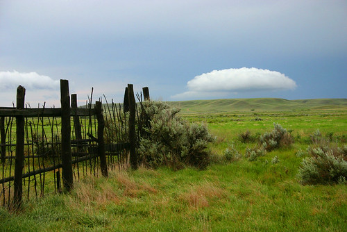
after the storm
after the rain. Grasslands National Park.

I took few photos today. I was not in a sight seeing frame of mind. Distance on the prairies is deceiving, even with a map to guide, and I have a long way to travel. Winnipeg tomorrow.
hitching a ride
Found this little guy checking me out when I woke from my nap. I don't think he wanted to eat me.

For most of the day I travelled into a headwind. A bit of a hassle because it requires greater concentration to keep the car on the road. But the winds have a pleasant side to them as well. The grasses at the roadside are green and at times are mixed with the silver tips of barley. In the wind the shimmer like ocean waves. Organic, rippling, these are Saskatchewan seas.

Haiku (composed long ago)

Saskatchewan seas
An early summer wind blows
Green waves across fields

level crossing
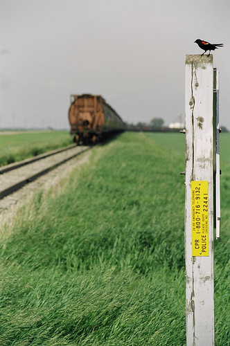
A bird on a post somewhere in Saskatchewan.

There are oil rigs all through southern Saskatchewan. They are clustered more frequently and in larger numbers than I ever sawin Alberta. Industrial metronomes pulling oil up and out of the earth they age like farming machinery, looking rusty and crusty as the years go on.

Thursday, May 17, 2007

journey east: day 12 - part 2

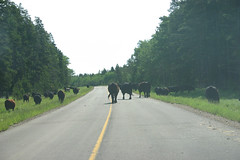
From the Elkwater townsite I once again headed back into the park. Bison used to roam the hills that make up the park, but like those of the plains, the bison are now all gone. The park wasn't always public either. It used to be private land and when the park was created local ranchers were compensated with rights to graze their cattle in the hills. It makes for an interesting wilderness experience. Last night I could hear cows beyond the hill on the other side of the lake mooing into the darkness. This morning, on my way out of town, I came across a cowboy moving a herd along a road, and a little further along I came across another herd.

I wonder what it was like in the hills here 10,000 years ago. During the last ice age, when ice sheets half a kilometre thick covered the prairies, the Cypress Hills were spared. They were they only oasis of land between the Rockies and the Atlantic Ocean. I can't imagine.

ice free forever
View from an island. The plains in the distance were covered in ice during the last ice age.

The trip through the park was nice. The weather was sunny and warm and there was no other traffic on the road, which wasn't surprising because it was a dirt road. Not gravel. Dirt. I learned later, the next day actually, that there is a profound difference between a gravel and dirt road. While travelling this dirt road I came across a mob, if that's the right word, of butterflies in the middle of the road lunching on a pile of shit. Ah, such vile beauty. I also came across a funny sign that posted both the speed limit, 40 kilometres and hour, and a warning that speed limits are enforced using photo-radar. Good luck getting a ticket on these roads.

Once I was on the Saskatchewan side I took a short detour to the Fort Walsh National Historic Site.

no way man, I've got more shit on me.
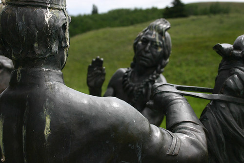
Fort Walsh was established by the North West Mounted Police in the late 1800's. It was built in response to the massacre of Nakoda people in 1873 by a group of angry white men on horses who rode up from Montana looking for horse thieves. Among other things, the fort aided Lakoda refugees led by Sitting Bull who were fleeing the Sioux wars of 1876-1877. A bronze statue at the information centre marks Sitting Bull's arrival at the fort.

I left the park and was momentarily filled with glee that I was once again driving on asphalt. It was a short lived glee. Every few hundred metres there were signs warning drivers about 'pavement breaks' which were accompanied by little red markers placed at road level right where the pavement was broken. The pavement was really broken. Reall, really broken. There were times I would drive 200 too 300 metres on the wrong side of the road to avoid broken pavement.

Now, of course this was not the Trans Canada Highway I was on. This was more a tertiary highway and I suppose in the grand scheme of things traffic levels don't justify the outlay of money for repairs. It was not just roads that were neglected. The rail line had been taken out too, and whole towns were disappearing.

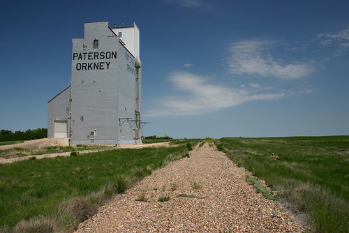
I passed through Climax, where I had to go just to say I had been to Climax, with its cute though predictable sign on the way out of town that reads, 'Hope you enjoyed Climax, please come again,' and soon came to Orkney. About 40 km of highway 18 separates Climax and Orkney, and what a difference 40 km can make. Orkney is a town no longer. As a kid I used to think of ghost towns as a cowboy, old-west kind of thing. But they are a new-west kind of thing too. And at the root of the emptying of urban settlements like Orkney looms large a simple fact: the rail road goeth no longer.

Orkney 6
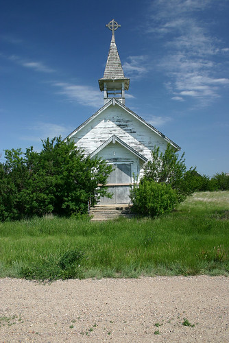
There is not much left in Orkney. Homes and businesses are abandoned, the school is empty, and what was once a commercial block is now evident only from the outline of its building's overgrown foundations. The population of white-tail deer was higher than that of humans.
Orkney 3

There were still two homes in town that looked occupied, but I didn't have time to get nosy with the residents. While taking photos of a row of houses, I came around a corner and startled two white-tail deer, who promptly startled me. The whole town was eerily silent, save for the songs of birds and the whispering of a warm prairie wind. Periodically a car drove through town, east to west, west to east, didn't matter, the driver's eyes firmly planted on the road ahead. Sometimes it's rude to stare at wrecks at the side of the road.

I arrived at Grasslands National Park in the late afternoon, checked in at the park office, then headed into the vast open space of the park for the night. I didn't take many notes that night. I was a little overwhelmed by the scenery. Following is my last journal entry for the day.

June 13, 2006

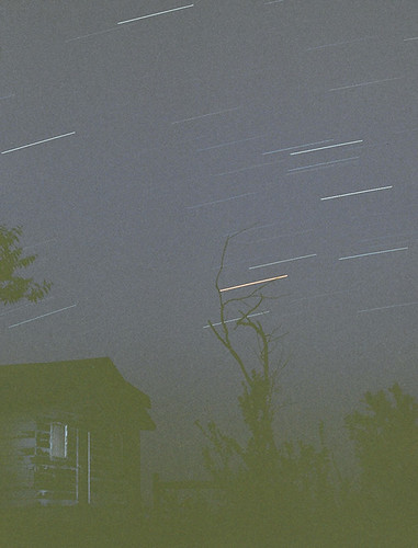
star streaks
Stars in a prairie sky.

Eleven minutes remain on my first long exposure photo of the night. Sitting in the tent doorway, I realize I am happier than I have been for a very long time. Above me the biggest sky I have ever seen, full of stars, wonder and promise.

moonrise
I can't imagine a better way to end the day than with a full moon rising.

Wednesday, May 16, 2007

journey east: day 12

Finally, day 12. It was starting to feel a little like the movie Groundhog Day around here. Although I have a feeling this will be another multi-entry day.

June 13, 2006

morning
Last morning in Alberta.

I started early today. It's hard to sleep in the face of the rising sun. I slept fitfully last night [probably because of cougars checking me out] and woke early. After packing things up I went for a thirty minute hike. The sign at the trail-head called it The Lake Loop. Well that was a bit of a disappointment. It looped, but it didn't loop around the lake. Rather, it looped back up into the woods. Not terribly scenic, or exciting.

Spruce Coulee
The best part of Spruce Coulee.

Back on the road and beyond the gravel I passed back across a plain I had crossed the previous day. This morning it was swarming with birds out looking for breakfast. There were two types of birds, both just a few inches from beak to tail and each remarkable in its own way. One type of bird was a deep sky-blue with silver trim. Dozens of them skimmed across the field, little blue streaks flying against blue sky, then dipping through green grass.

The other type of bird was rather unremarkable to look at. However they could hover in one spot for a short period, despite a rather strong wind blowing in from the east, then swiftly glide just above ground level, wingtips brushing the grass looking for food. I didn't even try to get photos of them.

Everything a vacationer could want was available at the Elkwater Grocery and Restaurant: junk food, beer, cigarettes, postcards, romance novels, firewood, and pancakes served with maple syrup [which I spilled in my journal.] This is where I had breakfast. The woman who served me said the town's population is 67. I find that number hard to believe, but she assures me that in the off-season that number dips to around 30.

For such a small town, the restaurant was pretty big. And I was the only person there. It is not until now, as I look back on it, that it kind of creeps me out. I remember it now as the kind of place where a car drives into town and vanishes. The wind was formidable, the streets were empty, and there was no one to be seen. Had a great visitor centre though.

Soon I was back on the road, heading east through the park, for Saskatchewan.

There are two animals that haven't done so well in encounters with the car. Richardson's ground squirrels and a particularly daring kind of swallow - at least I think they're swallows.

My killing spree started yesterday with the swallow-like bird: dark grey with white feathers in the tail - usually that's the only part of them I see. It is like they are playing a game of chicken with me. Call it sparrow instead. A group of sparrows hanging out on the pavement, presumably eating dead stuff, dare each other to see who will be the last to take off. Yesterday one zigged when it should have zagged and flew straight into the front wheel of the car. Man it was fast. The sparrow was doing ok too, just took a wrong turn.

This morning it was Richardson's Ground Squirrels, which a lot of people call gophers. What I noticed while travelling these last few days is that for some reason, these furry slim rodents measuring up to 30 centimetres long seem always to want to be on the side of the road they're not already on. Come upon one at over one-hundred kilometres an hour as it is making its first tentative strides across hot asphalt and it will promptly do a 180 degree turn and do a wheelie as it accelerates back to the shadows of grass growing at the side of the road. Sometimes I come across them lazing about in the middle of the road. They aren't always successful in keeping out of danger. Today I hit two of them. Just like that the life is crushed out of them by a tonne of rubber.

Cypress Hills Park cows on the road
not a herd of Richardson's ground squirrels.

On one occasion I came across two Richardson's in my lane. One safely skedaddled to the nearest side of the road. The other one made a lunge for the other lane, stopped, then started again before making one of those wheelie moves straight at the car. If I hadn't seen it happen I may not have noticed the slight bump. Further down the road I hit another one, connected hard with the ass of a not swift enough swallow, and then just barely missed another Richardson's that, when I last saw it in my rear-view mirror, was standing frozen and erect right on the centre line of the road.

Tuesday, May 15, 2007

journey east: day 11 - an epilogue of sorts

June 12, 2006

The prairies are flat, with lots of horizon, and really big sky. That is sort of what prairies are all about. So the Cypress Hills, which rise 600 metres up out of the prairies, should really stand out. But they don't. In fact, they seem to appear out of the flatness rather abruptly, like some optical illusion or local practical joke meant to freak out tourists.

Spanning the Alberta/Saskatchewan border the Cypress Hills Interprovincial Park was one of the areas I originally planned on hanging around for a while. I wanted to explore the area, meet the people, see the sights, smell the air, breath it all in, and hopefully have a lasting enough experience I could write about. But Writing-on-Stone was an unexpected and overwhelmingly delightful experience that, when combined with a visit to the Etzikom Museum, sort of sucked the day's ration of exploration energy out of me - and a good chunk of time. So, by the time I reached the Cypress Hills area it was later in the day than I had expected.


Like Banff, Jasper, and any number of other parks, Cypress Hills has a town within its boundaries: Elkwater. According to the map of the park I picked up back in Milk River it didn't look too far between Elkwater and the campground I was heading for, so I decided I would head back to town once I got myself settled. I drove on and up along a winding road into a thickening pine forest. This was the most trees I had seen in days.

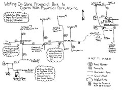
Maps serve as guides, thumbnail sketches of an area at 1:150,000 scale, but often do little to alert the reader to what he will really find on his journey other than generalities. What does it mean if a road is unpaved? Is it dirt? Gravel? Soybean? Maps tend to offer few clues. Scale can be deceiving as well. Thus I found myself, with the sun hurtling toward the horizon, riding along a gravel road up over hills and down through hollows on a short journey, by the map's scale, to the Spruce Coulee campground.

map
I'm not sure where this map came from, but I'm pretty sure I didn't rely on it to get me anywhere.

For a seemingly short journey it seemed to take forever to get to the end of the road, and I have to say I was a little disappointed when I finally arrived at the campground. It looked like one of those places people go for long-weekend parties. It was a tough looking, hooligan attracting, campground with evidence of campfires held in non-designated campfire areas, faded beer cans scattered in the bushes, and the campsites themselves looked a little shabby.

But it wasn't a long-weekend and I was only staying one night. And I had the whole place to myself.
As I hauled my gear from the parking area to the campsite I had chosen a pick-up truck arrived. Great, I thought to myself, here come the hooligans. But it was only a park ranger who seemed a little lonely and kind of surprised to see me. We had a conversation I sort of wish we hadn't had.

John: Hi.
Ranger: Howdy
J: Nice evening, eh?
R: Yup. Hope you don't mind the flies.
J: Flies are okay. I don't imagine there are any bear in these parts are there?
R: Nope. Killed the last one 'bout a hundred years ago.
J: Hmmm. That's too bad.
R: Yup, 1905 I think it was.
J: Well, at least I don't have to worry about them. I've been camping in the mountains for a week. Hungry bears sort of have an effect on you.
R: Nope. Don't have to worry bout them here.
pause ...
R: Now Cougars on the other hand.
pause ...
J: Cougars?
R: Yup. There was a fresh kill just a week ago down near the town.
J: Fresh kill?
R: Yup. Deer.
J: phew.
R: Well, gotta go.
J: Er, right, thanks for the chat.
Ranger hops in his truck and is just about to drive away when ...
J: Hey, can you come here for a moment?
R: Yup.
J: (pointing to paw print in mud) What's that?
R: Probably a dog.
J: You sure?
R: Pretty sure.
J: K. Thanks.

Silent death lurking in the forest. Statistically speaking I knew the odds of being tender vittles for a 150 kilogram cat were greater than being struck by lightning, but ... I built a good fire and kept it stoked until the scotch had made me brave and the pot had made me mellow. I never did make it back to Elkwater that night.
Spruce Coulee
The best thing about Spruce Coulee at Cypress Hills Interprovincial Park.

Thursday, May 03, 2007

journey east: day 11 - part two

The second of three parts. This was a really full day for me. It was my intention to visit a few specific areas along the way and immerse myself in them with the aim of later writing travel pieces on them. Southeastern Alberta was one of my focuses. However, my notes have since been misplaced and the prospect of writing about them, beyond these pages, is vastly diminished.

By the time I finished my day, at Cypress Hills Interprovincial Park, I was pretty done in and the prospect of touring the area for fact-finding just wasn't doing it for me. It also didn't help that though the weather was fine - sunny and hot - I was still early in the tourist season. Most places I visited, not just in Alberta but on my entire journey, were pretty empty of activity.

June 12, 2006

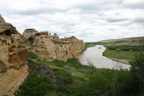
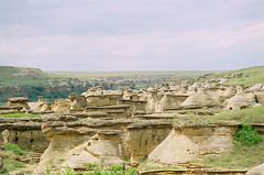
Writing-on-Stone Provincial Park lies in the Milk River Valley and appears almost out of nowhere on Alberta's southern plains. Driving across the prairies through flat fields of farmland and sagebrush and suddenly the road dropped down over a ridge and into what looked like the largest termite colony in the world.

Writing on Stone Provincial Park
Hoodoos at Writing-on-Stone Provincial Park.

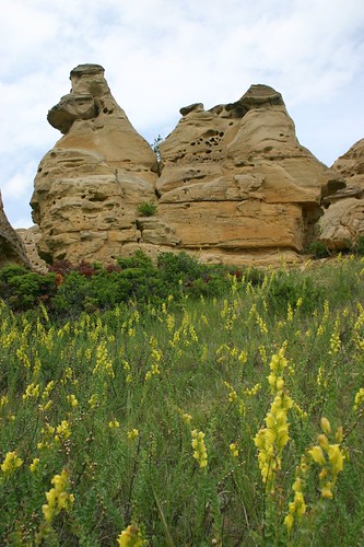
Hoodoos. A collection of striated pillars of sandstone worn away by meltwater 15 millennia ago when the glaciers last retreated from the area. The hoodoos run for miles following the valley of the Milk River. The park gets its name from pictographs depicting moments and events of the Blackfoot indians. The pictographs are painted images, but there are also images called petroglyphs carved into the soft stone. The images are crude and some are more than 1,000 years old. The Battle Scene is the most elaborate of the petroglyphs, covers a couple square metres of stone and has more than 130 figures in it.

It's a remarkable, magical place to explore. The Blackfoot refer to it as a living outdoor cathedral. Writing-on-Stone is a priceless part of the area's heritage. The tragic irony, and perhaps most frustrating element of the park, is the level of vandalism by those who get some joy from carving their initials or names into the stone. A shining example of this is at the Battle Scene. The dominant carved feature isn't the Battle Scene itself, but someone's initials carved deep and bold just inches above it. To protect it from further damage there is now an unsightly steel-mesh grating surrounding the scene. Aaargh, grating indeed. Posted throughout the park are signs warning against defacing the stone - $50,000 penalty - but, something tells me there have been few convictions.

Also in the park, but in a restricted zone on the other side of the Milk River, is an old North West Mounted Police outpost. This early in the season the park wasn't yet offering tours of the area. However, being early in the season also meant fewer people. In fact, almost no people.

hoodoos

I went for a hike along the Hoodoo Trail. It wanders through hoodoos for close to a kilometre, then dips down to river level where it takes a meandering trip through dense brush on the river's flood plain. The trail then heads back to higher ground, ending at the Battle Scene. Turkey vultures, swallows, magpies(lots of magpies,) pelicans and deer call the area home. The air is alive with birdsong.


I have made the point before that I was travelling just weeks before kids were let out of school bringing on the full onset of the tourist season. I was at the shoulder of the shoulder season. My timing presented problems and opportunities. One of the problems was the lack of information at many of the sites I visited. At Writing-on-Stone there was only one person available to talk to and she wasn't on site. I had to travel to an administration area of the park, after I'd finished wandering the park, to meet and speak with her. And of course I wouldn't get a tour of the restricted area because it wasn't open yet.

On the other hand, I pretty much had the park to myself. When I arrived there was a school group wandering one area of the park. But within an hour all the 'tweens piled on their tour bus and were gone. The parking lot was mostly empty and the only sounds were made by animals and the wind.

Milk River
The Milk Rivers runs through Writing-on-Stone Provincial Park.

As I walked the park I understood why the Blackfoot held the area with such reverence. Aisinai pi - where the drawings are - has been visited by the Blackfoot for thousands of years. It's a holy place. Walking through the silent corridors created by hoodoos and coulees I felt those thousands of years of lore, magic, and history, crawl up my spine with a tingle. It's a sense of context I don't think I could have experienced had I not been alone in my visit.

From Writing-on-Stone I turned north toward foremost. Foremost is not much of a town in terms of size. One section of road with commercial and government operations on both sides, and the ubiquitous small-town manner of parking on a slant. I parked in front of The Liquor Cabinet, which was closed, as in no longer in operation, and popped into The Liquor Store which was right next door. I bet that was a good drag-em down fight for market dominance. The store was spacious with booze spread thinly along metal shelves. The prices were high, so I left.

I went a couple of doors down to a 'cafe' where I bought the most expensive cup of coffee of my life: $3.00. Now this wasn't some yuppie coffee brewed from beans predigested by apes and slowly roasted for 50 years to the exacting standards of the Juan Valdez credo. This was coffee brewed in Foremost and served by a girl who based her pricing on an estimation of how much coffee my portable mug held. I'm happy to report the coffee didn't suck, it was in fact quite nice and far exceeded my expectations. But, it was not a $3.00 cup of coffee.
Tomorrow, Etzikom and photos from the roadside.

Wednesday, May 02, 2007

journey east: day 11 - part one

There was something special about this day. It was my first foray into the truly unfamiliar. The summer before I had been to Lethbridge with Meaghan and we had explored much of the surrounding area. Everything to this point on my trip, the mountains, B.C.'s interior, Southwestern Alberta, was familiar. Everything from this day forward, until my arrival in Fredericton, would be new to me. I didn't know what to expect and I was excited.

Some of my journal entries were pretty long. I packed a lot into this day and when I reached the campsite at Cypress Hills Interprovincial Park I filled many pages with my thoughts. Because of this I'm going to break the day into three parts.

June 12, 2006

travelled 424km today/1758km total.

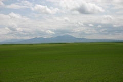
I left Lethbridge around 10a.m., heading south-east toward Milk River. About 30 minutes outside Lethbridge, just north of Warner, I came over a rise and far to the south, blue in the haze, I saw a mountain. I thought it might be my first glimpse of the Cypress Hills, but the direction was wrong and it seemed to soon in my trip. It was a remarkable sight to see: this lump thrusting up out of the flat prairies and into the clouds, with a central peak shaped like a ziggurat

Sweetgrass Hills
The Sweetgrass Hills of Montana.

Twenty minutes later I was in Milk River where I learned I had been driving toward the Sweetgrass Hills in Montana. The Blackfoot name is Sweetgrass Mountains but apparently something got lost in translation. No biggy. Still later, when I was at Writing on Stone Provincial Park(which I'll get to in a moment,) I was told there actually very little sweetgrass in the area.

Milk River is just a few kilometres north of the border with the United States. I stopped in at the information centre where I spoke with William. In his 20's, William was from the area. His grandfather was a homesteader who moved to the area from Minnesota during the early 1900's. He said many of the early homesteaders were from around Minnesota as well as from Utah. The mormon population of the region is sizeable.

William has a farm a little ways away where he grows durham wheat. Durham is the dominant crop grown in the area, along with some mustard and a spattering of canola. He said there was a lot of canola grown until about 15 years ago, when Monsanto moved in. "A lot of farmers lost their shirts," he said and it just isn't grown anymore.

The mouse and gopher population seems healthy. There are an awful lot of hawks dining near the highway. Yesterday I watched one swoop down to the median, brake hard, then flap like mad back into the sky with a furry little critter twitching in its talons. Swift death from the sky.

At Milk River I turned east. It was here, along route 501, that I saw a badger scuttle across the highway. I learned later that badgers are nocturnal animals and a daylight sighting was rare. I'm just glad I didn't hit it. Low, sleek and built with a neck like a pitbull it hugged the highway as it crossed just metres in front of the car. I'm not sure what damage it would have done had we met tire to fur.
Ah, to be blessed with a landscape like Alberta's. That is if you are in the business of building and maintaining a highway system. The best highways on my entire trip were in Alberta. Many are divided highways with wide shoulders that run straight for as far as the eye can see. The flatness of the prairie makes it hard to judge scale. A problem not limited just to distance, but also to speed. On more than one occasion I looked down and saw the needle on the speedometer creeping into the 150 kilometre an hour zone, and beyond. Even the gravel roads were better maintained and easier to drive than some of the secondary roads in other provinces - Saskatchewan had scary roads.

Tuesday, May 01, 2007

journey east: day 10

And yet another day, June 11, comes and goes without a journal entry. I just took a quick scan ahead in my little black notebook and see a pattern. When I was alone on my journey east I wrote in my journal. When I was with company, either family or friend, I didn't write.

So, once again the best of my recollection of the day.


What can you say about Lethbridge? I stayed with my sister Heather and her partner Barry. My visit came just around one year after they had moved there from Vancouver. It felt good to arrive and they had four seasons of experiences in a new land to share with me.

garden critter
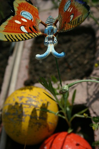
a critter in Heather and Barry's garden.

Heather and Barry are one of the few couples I know who walk the talk about minimizing their ecological footprint. Barry had been busy setting up a water reclamation system to capture runoff from the roof and there were 20 litre buckets all around the yard, some contained water, some didn't. A large barrel of water sat next to the house. The reclaimed water was destined for the garden. Laundry hung on a line that criss-crossed the yard and the garden was already being worked.

You can never have enough clothes lines. When I see one I'm taken back to my childhood, a simpler time, and I think they symbolize a way of life that is far less rushed than the ones many are living today. I wonder if anyone has ever studied a link between the prevalence of clothes lines and quality or pace of life. Do we live better when our clothes come in fresh and fluffy from the backyard?

There were a few errands I wanted to take care of and some sights I wanted to see while I was in town. Barry was off in the morning to work and after a nice homemade breakfast I was off to see a bit of Lethbridge. Heather seems quite taken by the city and I can understand why. It doesn't seem to have outgrown itself. Somehow, with growth, it has maintained a sense of what it is that gives it character. The city has a downtown area stereotypical of cities in the area. Wide avenues with slant parking and building that rarely climb much higher than four or five stories. It sprawl, but not in a suburban way, more like in a cowboy hanging out on hay bales kind of way: relaxed and casual, but purposeful.

Lethbridge is cut in two by the Oldman River. The river valley cuts 100 metres down through the flat prairie landscape on which the city of 80,000 is built. Two notable architectural features of Lethbridge involve the valley. First, the University of Lethbridge is located on the west side of the valley. University Hall looks like a recent addition to the campus and it is this building that is most striking. It looks as though it has slipped down into the valley. The long structure cuts through the ridges of coulees lining the steep valley walls and flows down into their troughs. It's a most unobtrusive and organic design, and looks like the valley has grown around it.

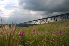
The second architectural feature spans the valley from east to west and is the polar opposite from the University of Lethbridge campus in that only a blind person could miss it, and even then I'm not so sure. The High Level Bridge was built by the Canadian Pacific Railway in 1909. It stands 100 metres above the lowest part of the Valley and stretches more than 1.5 kilometres from end to end. It is the longest and highest bridge of its kind in the world and is truly spectacular to look at. I get shivers just thinking about crossing it on foot.

rail trestle
The High Level bridge in Lethbridge is the highest and longest bridge of its kind in the world.

Beyond my sightseeing I had a few necessities to pick up. I found a game shop that sold large dice. I picked one up for myself to replace that which was stolen by the felonious raven in Yoho, and a dozen and a half for mom (she has a dice fetish.) I bought a $2 pair of sequined flip-flops for footsie protection in alien public showers. And I bought a $20 phone card that gave me a remarkable amount of minutes of long distance chatting so I could keep in comfortable contact with my honey.

And no, my mom doesn't really have a dice fetish.

Monday, April 30, 2007

journey east: day 9

I don't have a journal entry for June 10, 2006. I did stuff though, so the following is the best I can recollect from that day.

It was a beautiful morning. Lurking above us to the north, Mount Field glowed warmly in the morning sun. There was little in the way of cloud in the sky, and I was itching to pack up the site and hit the road. Neither myself nor Greg and Derek, who were driving to Greg's cottage near Vernon, had a long day of travelling ahead of us, so we opted to go for one last hike in the morning.

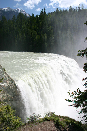
After cramming all our gear in our vehicles - Derek's jeep oozed camping stuff from every available crevice - we drove wast to the park boundary and the trail head for Wapta Falls. This would be the least intensive hike of any of the trails we had been on in our three years of camping. A couple of kilometres of graded trail that looked suspiciously like an old road, followed by a short walk in the woods, and Greg and I - Derek remained with the gear oozing jeep - found ourselves at Wapta Falls. We could hear the falls long before we saw them, and when we saw them finally it was an impressive sight.

Wapta Falls
Wapta Falls.

In the past I've mostly spent time in the mountains in the latter part of the summer, usually August and September. Here I was though and spring wasn't even officially over for another two weeks. All the flowing water was flowing harder, faster, whiter and louder than I had experienced before. It was grand.

At Wapta Falls there is a berm of debris or stone at the base of the falls. Footpaths wind around its base and criss-cross their way to a slightly flattened patch at the very top of it. Later in the season, when most of the snow has melted and the Kicking Horse River is running a little slower and not so high, visitors to the falls will be able to walk right out to the berm. Looking down on this wedge of stone set in the pounding mists of the falls I wanted to stand at the apex of the trail and feel the wet wind pass me. Another reason to return.

A short while later we were back at the parking lot. Our departure was devoid of maudlin moments. We agreed the past three years of hiking had been fabulous and pledged to do more, vowing to meet the following summer in Newfoundland - which is just a couple of months away. Turning out of the parking lot was odd. Derek and Greg turned west and I watched them disappear down the highway before I turned east. I was headed back toward Field, but didn't get far before pulling the car onto the shoulder of the highway.

You go west, I'll go east
You go west, I'll go east. See you in a year.

A couple years ago Parks Canada did a controlled burn in the Hoodoo Creek area of the park. The campground had been closed for a few seasons and the trees burned along the mountain side above it left a remarkable pattern. I think forest fires are one of the least understood natural events that occur in forests. They mark renewal. They also make for wonderful landscapes. Meaghan and I drove through Yellowstone National Park a decade after it was ravaged by a massive forest fire, and it was one of the most remarkable trips I have ever been on. It doesn't take long for life to fill the charred void left by flames. I wanted to hike the Hoodoo trail, but park staff said the area was still closed for the season. Sometimes I wish I was a bit more of a bad-ass.

hoodoo creek
Result of a controlled burn at Hoodoo Creek.

I was off again, heading toward Field, toward Alberta, toward the East Coast. I stopped one last time at the side of the road at Field. I didn't want to leave. My time in Yoho was a diversion from the reality I was on a one way trip away from Vancouver and everything I had know for the past 10 years. It hadn't been difficult leaving the city, but this was something else. I didn't want to leave the mountains. It broke my heart.

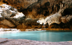
Soon enough I was passing a giant Alberta sized sign welcoming me to that province and a short time later I was in Banff. The town of Banff never really interested me. I'm not a big fan of hordes of tourists and even this early in the season it was chock-a-block full of people from away, albeit I was one of them, but I admit that begrudgingly. I wanted to visit the place where it all started. Cave and Basin National Historic Site is where the first national park was established in the country. Its genesis came from the discovery by a Canadian Pacific Railway construction worker of a cave and a hotspring in Banff. Two years later, in 1885, the area was officially designated a national park. Rocky Mountains Park later became Banff National Park.

The basin is a rather unremarkable stone depression at the base of a mountain. The stone is yellowish in colour and the surface of the water is covered in a bulbous layer of algea. It must have taken a truly entrepreneurial imagination to think it could be cleaned up enough to entice high paying tourists to take a dip in its scummy warm waters. Somehow they made it work.

cave
The cave was quite remarkable. The room was lit by sun coming through a hole in the roof. It created one of those god-like shafts of light that are usually accompanied by a choir singing 'ahhh.'

The remarkable part of the site though is the cave. After paying my seven or nine dollar entry fee, which I never have a problem paying when it's a national park or some other not-for-profit venture, I stepped into a long shallow cave that led slightly upward. As with death, there was light at the end of the tunnel and it opened up into a larger space with a pool of water to one side and hole in the ceiling through which a shaft of sun poured. The sunbeam was focused on a man sitting on a wooden bench in one corner of the cave. I don't think I could have timed my trip better.

I hit the road again, with Lethbridge on my mind. A look at the map showed a seasonal road that ran north/south at the foot of the mountains. I turned off the Trans Canada and started to follow it. Have you ever had one of those nagging feelings that the sign you just passed, the one you glanced at but didn't really absorb, deserved to be absorbed? I had that feeling a few kilometres down the road, so I turned around to have a close look at the sign. Boy, that was a time saver. The sign said the highway was closed at the 56 kilometre mark. There was no through traffic.

Back on track I took a more direct and familiar route to Lethbridge. Along the way I stopped in at Fort MacLeod to pick up some post cards. Meaghan and I had been through this area the year before so things were feeling fairly familiar. It was getting late in the day though and not many places were open. I stopped in at a restaurant to take care of a ready to explode bladder and asked a local where I might find a store that sold touristy stuff. I was sent to the Greyhound Depot. Right. It was closed but gave me a great photo opportunity. I eventually found postcards and within 40 minutes I was knocking on Heather and Barry's door in Lethbridge. Yehaa.

Friday, April 27, 2007

journey east: day 8

This entry marks the last full day of our trip to Yoho and my last full day in British Columbia. Reading back through the journal I couldn't have asked for this day to have started in a better place. Yoho seems to be a fairly small park when compared to its more glorified sister mountain-parks like Banff and Jasper, but it packs quite a bit of punch into its small area. Lake O'Hara is just one of the places in the park that stands out, regardless of the season.

June 9, 2006

I made it through the night in the hut quite nicely, although it was probably the most fitful night yet. The fire burned through the night and during moments of sleeplessness I would untuck myself from the deliciously warm and cozy confines of my sleeping bag and throw as large a piece of wood on the fire as the little stove could handle.

Part of my sleeplessness stemmed from the knowledge I was bedding down in what is essentially a kitchen. Sure it hasn't been used much in the past few months, but do the bears know that?
I prefer sleeping in a tent to sleeping in the open. My understanding of bears and tents is that bears are confused by tents. They just don't get them and for the most part leave them alone. In the cooking shelter, and I stress the cooking part of that, I was painfully aware that I was sleeping among scents of yummy. What I needed was an early warning system. There were shovels and other long handled tools about. I strategically placed them in the doorway of the shelter. It was my hope that should a hungry just awoken from a long winter nap grizzly happen upon me I would have enough time to wake up for the dining experience as it blundered through my nest of tools. And I slept with a can of bear spray under my pillow.
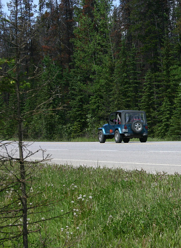
We tried to hike to Lake Opabin this morning, but snow at Opabin Plateau kept us from getting more than half a kilometre from the lake. The hiking today was wet. It was a fine drizzle that didn't really seem to fall. It just lingered in the air soaking everything that passed through it. The rain from last night made the remaining snow cornices heavy and we were treated to an avalanche on our journey back to the campsite. The whole time we were in the area no more than ten minutes would pass without the hearing the crack and roar of snow and ice tumbling down mountain faces. Low clouds kept us from seeing all but the one.
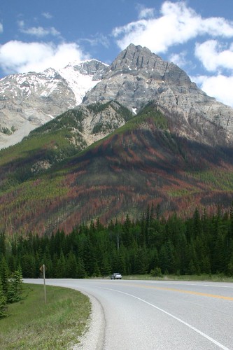
We hiked in silence for most of the morning. The area leading to Opabin Plateau deserved the silence. The sound of avalanches and ice falls constantly thundered through the valley. For the most part the action was hidden in a shroud of clouds. It wasn't until our hike that I realized the sounds I had heard in the night was that of avalanches. I thought all the rain had brought a thunder storm with it.

The higher we climbed and farther into the valley we hiked, the deeper and more impenetrable the snow became. Further limiting our progress was the amount of melt water run off forming pools and travelling in streams hidden beneath the snow. The dominant tree in the area was the Larch. Their needles turned orange littered the snow beneath their branches. It was a beautiful display of colour in such a monochrome landscape.

We visited the Alpine Club of Canada hut at O'Hara. We were greeted by a not-so-shy marmot and a couple of whiskey-jacks. I'd like to come back at this time of year again to take pictures. The Opabin Plateau was beautiful. btw - Oesa is Sioux for ice: a fitting name considering its namesake lake we visited yesterday was mostly covered in it.

Like the hike up, the hike back down to the parking lot was uneventful. Between the kilometre two and kilometre one distance markers I counted paces. 1,111. Unbeknownst to me Greg did the same thing for the last kilometre, but stopped when he reached 1,000. He figures he was a couple hundred metres shy of the parking lot. That's what boredom does to you.

When we got to the bottom - I was there first - I propped my bag on the narrow shelf of a sheltered information kiosk and leaned my hiking pole beneath it. I had to pee. As I walked back to the kiosk my bag leapt from the shelf and crushed my hiking pole. It was bent two-thirds of the way down. Damn. I guess I need to get a new pole.

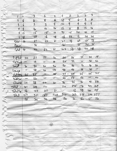
Our final night at Kicking Horse, regrettably, was without a fire. Tired and cold after our day's journey we settled at a picnic table in one of the campground's shelters. We drank beer and played Yahtzee for most of the night. Despite the absence of a fire it was a delightful end to our tour of Yoho National Park. I couldn't have asked for more. Besides, I won four of nine games, rolled five Yahtzees, and managed a high score of 321. Yahoo.

yahtzee
Look at those scores. I throw my gauntlet down, for I am the Yahtzee King.

Tonight is the last night I will spend in British Columbia for a long time to come. It's not a night without regrets, though they are small. I move to Fredericton, on the whole, without regret. Meaghan and I have a future together that will be better served living in Fredericton than in Vancouver. However, there is so much of this province I have left unexplored. Likely 95 per cent of it. I guess I'll have to come back sometime.